Alexander Heilner

  • Projects
    • Draining the Colorado
    • The New Arctic
    • Last Cold Days
    • Imperial Water
    • Welcome Home
    • Synthetic Truth
    • E-470: Eastern Frontier
    • Development By Design
    • Biosphere 2
    • Extraction / Abstraction
    • Interweaving
    • Land Marks
    • Encyclopedia of NYC
    • Microbes
    • Leaving New York
    • Johns Hopkins Hospital
    • The Great Baltimore Fire
    • Landscapes by Night
    • Raleigh 2000
    • 47 (forty-seven) FRAMES
  • Information
    • News
    • Biography
    • Purchase
    • Links

The New Arctic

  • Project Statement »
Off-Road Tourism, Longyearbyen, Svalbard
Outside of Longyearbyen, polar bears are a very real danger throughout Svalbard. The perimeter of the town is marked by signs warning of bears' ubiquitous presence, and tourists love to take home photos of the signs (not to mention t-shirts, postcards, artwork; and occasionally the actual signs themselves). This guided tour group was headed out of town on ATVs, but stopped at the sign for the requisite group selfie.
Cruise Ship, Leifdefjorden, Svalbard
Less sea ice means longer cruise ship seasons in the Arctic. 124,000 cruise passengers visited Svalbard in 2019, up 500% since the mid 1990s. As tourism rebounds after initial pandemic restrictions, scientists and environmentalists have just proposed a set of restrictions designed to protect the delicate arctic ecosystem, and the cultural heritage of remote sites. Among the proposed rules, ships will likely be limited to 750 passengers, and landings may be limited to about 40 specifically designated locations, in order to protect wildlife.
Hurtigruten Ferry in Trollfjord, Lofoten, Norway
Tourism in the Arctic regions of Europe is accelerating, and the melting of sea ice will soon enable ships to travel the Northwest Passage, and stay more months in the far North. In an effort to remain profitable, the century-old Hurtigruten - Norway's primary coastal ferry service - has recently replaced most of its traditional vessels with more luxurious cruise ships.
Krafla, Iceland
Grindavik, Iceland
Vesle Raudfjorden, Svalbard
Collected Trash, Vesle Raudfjorden, Svalbard
The Arctic is far from pristine. This trash was collected in less than one hour on a short stretch of beach.
Marius Watches for Bears, Sheibukta, Svalbard
Lone Polar Bear, Leifdefjorden, Svalbard
This polar bear was ambling around this small island eating bird eggs, when our guide, Marius spotted her from across the bay. We were able to get reasonably close in a zodiac without endangering ourselves or the bear. Polar bears are famously threatened by the diminishing sea ice across the Arctic. They are fantastic swimmers - "marine bears" in fact - but they use the ice as a critical platform for hunting seals and other large animals. A diet of birds' eggs is unlikely to sustain these huge creatures through the snowy winters. Like many bears in Svalbard, this one was wearing a collar which allows researchers to track her, so they can better understand how polar bears are living, and adapting to the changing landscape. This is also how we knew she was a female. Apparently, the males rip their collars off within a day.
Svitjodbreen, Receding Quickly, Svalbard
I'm standing on a small island which was covered by Svitjodbreen, the glacier in front of me, less than 20 years ago. As glaciers go, this one is moderately sized - the face here is about 100 meters tall, similar to the Statue of Liberty. As I spend the afternoon contemplating its contours, they are incrementally changing as pieces of ice calve off into the bay. They look small from here, but each falling chunk is similar to a house or a city brownstone. The thunderous sounds and ensuing swells hint at the full dimension of what I'm witnessing. Svitjodbreen has receded more than two kilometers since the 1980s, and its retreat is accelerating.
Liquified Natural Gas Terminal, Hammerfest, Norway
The Melkøya Liquified Natural Gas Terminal sits on an island just off the coast of Hammerfest, Norway. Gas flows 104 miles from the Snøhvit fields under the Barents Sea, until it is liquified here and transferred to ships for dispersion across the globe. The terminal was completed in 2007, and marked the beginning of enormous growth in Norwegian Arctic oil and gas drilling, which is expected to continue in the coming years.
LNG Tanker, Hammerfest , Norway
The Melkøya Liquified Natural Gas Terminal sits on an island just off the coast of Hammerfest, Norway. Gas flows 104 miles from the Snøhvit fields under the Barents Sea, until it is liquified here and transferred to ships for dispersion across the globe. The terminal was completed in 2007, and marked the beginning of enormous growth in Norwegian Arctic oil and gas drilling, which is expected to continue in the coming years.
Liquified Natural Gas Terminal, Hammerfest, Norway
The Melkøya Liquified Natural Gas Terminal sits on an island just off the coast of Hammerfest, Norway. Gas flows 104 miles from the Snøhvit fields under the Barents Sea, until it is liquified here and transferred to ships for dispersion across the globe. The terminal was completed in 2007, and marked the beginning of enormous growth in Norwegian Arctic oil and gas drilling, which is expected to continue in the coming years.
Closed Coal Mine, Adventdalen, Svalbard
For most of the 20th century, coal mining was the primary economic engine of Svalbard, though it was rarely profitable, due to the difficult climate, and distance from mainland Europe. Today, all but one of the Norwegian mines have been shuttered, but the infrastructure bears witness to coal's importance everywhere you go.
Mine #7, Svalbard
For the past century coal mining has been the heart of Svalbard's economy. First, entrepreneurs and then state-run corporations (notably from Russia and Norway) have been digging into the mountains since the late 1800s, trying - and mostly failing - to turn a profit by mining in this remote corner of of the world. But in the 21st century, tourism has quickly grown into a robust alternative to unprofitable dirty energy, and the ubiquitous signs of mining life are now nearly all dormant. Mine 7 (shown here) is the last working Norwegian coal mine in Svalbard. It was slated to be closed in 2022, but after the invasion of Ukraine, plans to shut the mine down were put on hold, pending the growing energy crisis in Europe.
Mine #7, Svalbard
Geothermal Energy Station, Krafla, Iceland
Receding Glacier, Fuglefjorden, Svalbard
Scheibukta, Svalbard
A small group of artists boards a Zodiac after spending the morning on the edges of this spring ice flow.
LKAB Iron Ore Terminal, Narvik, Norway
After relying almost entirely upon the export of local iron ore for over a century, the port city of Narvik is marketing itself as a potential stopover for ships en route to and from the newly ice-free North East passage across the Russian Arctic Ocean.
Northlands Terminal, Narvik, Norway
Northland Resources recently completed this terminal to facilitate increased production of iron ore in the nearby Swedish mountains. The lease for the terminal land is only ten years, after which the port of Narvik hopes to take over the facility and convert it to a shipping hub for large containers. Narvik is marketing itself as a potential stopover for ships en route to and from the newly ice-free North East passage across the Russian Arctic Ocean.
Tromsø, Norway
Tromsø, the largest city in Northern Norway, is built around a bustling, but small, port. As ice melts in the Barents Sea, Tromsø is positioning itself to become a major hub for tourism and trans-arctic shipping, as well as drilling rigs and their attendant ships.
Longyearbyen, Svalbard
Longyearbyen, with its 2,500 residents, sits at the center of Svalbard. At 78ºN., It is the northernmost permanently inhabited town in the world, and it is the hub for nearly all human activity on the islands. Like all settlements on Svalbard, Longyearbyen began as a coal mining camp over a century ago, but today is well developed, and its economy has shifted in large part to tourism over the past 30 years. But as the main point for human engagement with the region, Longyearbyen is also on the front line of the environmental crisis. The Arctic is warming much faster than most of the world, and Svalbard's average temperatures are rising faster still.
Sukkertoppen looms over Longyearbyen, Svalbard
Walking around Longyearbyen, it's impossible to ignore the massive fencing being built up the side of Sukkertoppen, the mountain that looms over the east side of the town. In December 2015, an early morning avalanche blanketed an entire neighborhood, killing two people, and destroying dozens of houses. In the six years since, many residents have been relocated and this system of fencing has been instituted to hold back future snow slides. As the weather becomes more volatile in this part of Svalbard, winter storms have been producing more snow in some instances, and also more frequent rain, especially in the spring. Both scenarios can lead to a higher risk of avalanches - both snow and rocks. The town sits in a narrow glacial valley so many homes and civic buildings along both sides are being reconsidered as the local government works to assess the likelihood of future danger.
Avalanche Fences, Longyearbyen, Svalbard
Walking around Longyearbyen, it's impossible to ignore the massive fencing being built up the side of Sukkertoppen, the mountain that looms over the east side of the town. In December 2015, an early morning avalanche blanketed an entire neighborhood, killing two people, and destroying dozens of houses. In the six years since, many residents have been relocated and this system of fencing has been instituted to hold back future snow slides. As the weather becomes more volatile in this part of Svalbard, winter storms have been producing more snow in some instances, and also more frequent rain, especially in the spring. Both scenarios can lead to a higher risk of avalanches - both snow and rocks. The town sits in a narrow glacial valley so many homes and civic buildings along both sides are being reconsidered as the local government works to assess the likelihood of future danger.
Nybyen, Longyearbyen, Svalbard
Nestled at the head of the valley, Nybyen - "new town" - is actually the oldest part of Longyearbyen. (It's where rebuilding began after World War 2.) As concerns mount about future climate-induced avalanches, much of the population of Nybyen has relocated to safer parts of town, including most of the university students who used to live in this neighborhood. In recent years, new construction in the center of Longyearbyen has included several large, multistory apartment buildings and dormitories, which have quickly changed the feel of the small town. Even so, housing remains extremely tight, as residents relocate, and the population continues to grow steadily.
Longyearbyen, Svalbard
A tourist coach makes the short drive from Longyearbyen to the northermost commercial airport in the world.
Edge of Town, Longyearbyen, Svalbard
Outside of Longyearbyen, polar bears are a very real danger throughout Svalbard. The perimeter of the town is marked by signs warning of bears' ubiquitous presence, and tourists love to take home photos of the signs (not to mention t-shirts, postcards, artwork; and occasionally the actual signs themselves).
Adventfjorden, Svalbard
Longyearbyen is the hub of all econmomic activity in Svalbard. These ships are anchored off shore, as the tiny port can only manage a few ships at a time.
The Greenpeace Arctic Sunrise, Docked at Kirkenes, Norway
Located just a few kilometers from the Russian border, Kirkenes has a long history as a trading portal with Russia. Today it is an international port, where many Russian fishing and industrial ships prefer to work, as nearby Murmansk is iced in each winter. Kirkenes feels the last reaches of the Gulf Stream and is able to be kept open year round.
Global Seed Vault, Svalbard
The Global Seed Vault holds seeds from nearly all of the important crops and vegetation around the world. The intention is to have a "backup" set of genomes, in case natural or human-made disasters render certain plants extinct. The vault is built deep inside a hillside close to Longyearbyen's airport, in part to take advantage of the natural cooling properties of the arctic permafrost. But in recent years, the ground around the vault has begun to thaw, complicating the infrastructure.
EISCAT Radar Installation, outside Longyearbyen, Svalbard
GLOBUS Radar Installation, Vardø, Norway
The remote coastal city of Vardø has seen its population decline for several decades. But as shipping and energy industries accelerate in the Berents sea, Vardø is exploring new opportunities. Its geographical location at the easternmost tip of arctic Norway places it right at the edge of Russian oil exploration, and shipping lanes heading east across the North East Passage to Asia.
Satellite Ground Station, Svalbard
SvalSat is the largest commercial satellite station in the world, with over 100 antennae, and the ability to watch a low-polar-orbiting satellite throughout its circular journey around the polar region.
Arctic Colony, Raudfjorden, Svalbard
Everyone is clambering for a foothold in the Arctic Ocean. So, for a brief moment, I colonized my own little corner of the neighborhood.
Glacial Retreat, Fuglesfjorden, Svalbard
An afternoon's experiment inspired by John Pfahl, Andy Goldsworthy, and all of the topo maps of glacial recession I've been staring at for decades.
Perimiter, Reindyrflya, Svalbard
Whalers' Graves, Eolusneset, Svalbard
Before there were tourists, miners, or even trappers, whalers were frequenting Spitsbergen as early as 1620. Dutch, French, English, and later Russian hunters competed for bowhead whales in the area, and built summer camps on the island. Seen here at Eolusneset, are graves of whalers which have remained intact for more than 400 years (not a typo!). They are widely believed to be Dutch sailors who died in an infamous battle with French navy ships in 1693. The battle definitely happened; there is some debate as to whether these men were involved, or died in other incidents in the following years. Nearby is a cross erected in 1855 by a Norwegian ship captain to commemorate the 1693 battle. It's amazing that these memorials have weathered the extreme elements for hundreds of years. Eolusneset sits at the entry to Sorgfjorden - the Fjord of Sorrows.
Meridian Arc Survey Ruins, Crozierpynten, Svalbard
Villa Oxford, Reindyrflya, Svalbard
The "Villa Oxford" is one many trapping huts scattered throughout Svalbard. This one was built in 1924 by a trapper named Hilmar Nøis, and It sits on the bank of Reinsdyrflya, looking across Woodsfjorden. It is still used occasionally by visitors who make the long trek from Longyearbyen by boat or, in the winter, by snowmobile. Before there was coal, and long before there was tourism, hunting was one of the primary means of subsisting and/or making a living on Svalbard. Hunters would set out from settlements for many months, hoping to catch reindeer, arctic fox, and even walrus. We saw none of those animals here, but there was plenty of evidence of very recent visits by bears.
Cemetery, Longyearbyen, Svalbard
This cemetery is over a century old. Today, no one is permitted to be buried in Svalbard.
Pyramiden, Svalbard
From 1927 to 1998, Pyramiden was one of the most glorious towns in the Soviet Union. Except it is in Svalbard. Thanks to Svalbard's unique transnational status, The Soviet Union, and now Russia, have operated several mining villages in the islands for nearly 100 years. They rarely turn a profit but they allow Russia to justify a physical presence in a location that has rich geopolitical value as the Arctic becomes the new frontier for military and commercial expansion. Recognizing it as one of the only places that western visitors could experience Soviet culture first hand throughout the Cold War, the Kremlin lavished Pyramiden with a standard of living rare for working class Russians. Notice the grass in these pictures - these are the only lawns in Svalbard! But with the opening of Russian borders, the government abruptly pulled support for Pyramiden, and in just a few months in 1998, the site was evacuated and left to become a ghost town. For more than a decade, it sat, weathering the winters and the looters. But by 2010, the tourism potential became clear, and there is now a skeleton population of fewer than a dozen people who live in and maintain Pyramiden's hotel and culture house in order to serve visitors.
Pyramiden, Svalbard
Pyramiden's core mine shaft is located high above the town. It is a 1-hour climb to the top.
Dilapidated Dock, Pyramiden, Svalbard
Pyramiden, Svalbard
Russian infrastructure abandoned in 1998.
Billefjorden, Svalbard
Looking across Billefjorden from Pyramiden's abandoned dockyards.
Longyearbyen, Svalbard
Nordkapp, Norway
For centuries, Nordkapp -- the northernmost point in continental Europe -- has marked the end of a long journey; the place where one turned around to go home. Now, as Arctic ice melts, and wealthy, sophisticated tourists seek out more exotic and remote places to visit, Nordkapp will be just the beginning; the jumping off point for travels to Svalbard, Siberia, and indeed the North Pole itself.
Kjölur Route, Iceland
Grindavik, Iceland
Jökulsárlón, Iceland
Proposed Site of the Gamnes Oil and Gas Transfer Terminal, west of Kirkenes, Norway
This remote peninsula outside of Kirkenes, Norway will likely soon be built into a major transfer hub for oil and natural gas. As polar ice recedes, and drilling is more feasible in this region north of Norway and Russia, ships from both territories will need a place to offload their oil onto bigger, intercontinental ships for travel to Europe, Asia, and North America.
Grøtsund Port Construction, North of Tromsø, Norway
Tromsø, the largest city in Northern Norway, is built around a bustling, but small, port. As ice melts in the Barents Sea, and offshore oil drilling accelerates in Norway and Russia, Tromsø is positioning itself to become a major supply and repair hub for drilling rigs and their attendant ships. The Grøtsund facility is being built in anticipation of serving these newly active drilling operations.
Ullsfjorden, Norway
Tourism in the Arctic regions of Europe is accelerating, and the melting of sea ice will soon enable ships to travel the Northwest Passage, and stay more months in the far North.
On Board a Hurtigruten Ferry, Ullsfjorden, Norway
Tourism in the Arctic regions of Europe is accelerating, and the melting of sea ice will soon enable ships to travel the Northwest Passage, and stay more months in the far North.
On Board a Hurtigruten Ferry, Ullsfjorden, Norway
Tourism in the Arctic regions of Europe is accelerating, and the melting of sea ice will soon enable ships to travel the Northwest Passage, and stay more months in the far North.
On Board a Hurtigruten Ferry, Ullsfjorden, Norway
Tourism in the Arctic regions of Europe is accelerating, and the melting of sea ice will soon enable ships to travel the Northwest Passage, and stay more months in the far North. In an effort to remain profitable, the century-old Hurtigruten - Norway's primary coastal ferry service - has recently replaced most of its traditional vessels with more luxurious cruise ships.
On Board a Hurtigruten Ferry, Sørøysundet, Norway
Tourism in the Arctic regions of Europe is accelerating, and the melting of sea ice will soon enable ships to travel the Northwest Passage, and stay more months in the far North.
Ymerbukta, Svalbard
Glacial runoff from Esmarkbreen meets the brackish water in Ymerbukta. Until a few hours ago, the runoff had been solid ice, compressed inside the glacier, most likely for thousands of years. The other side of the glacier is also calving directly into the bay. But this site is a large flat moraine so the bay water is a murky mix of deposited dirt and rocks along with the melted ice and ocean water. The mixing is evident in these images.
Vardø, Norway
The remote coastal city of Vardø has seen its population decline for several decades. But as shipping and energy industries accelerate in the Berents sea, Vardø is exploring new opportunities. Its geographical location at the easternmost tip of arctic Norway places it right at the edge of Russian oil exploration, and shipping lanes heading east across the North East Passage to Asia.
National Vessel Tracking Service, Vardø, Norway
The remote coastal city of Vardø has seen its population decline for several decades. But as shipping and energy industries accelerate in the Berents sea, Vardø is exploring new opportunities. Recently located here, Norway's Vessel Tracking Service closely monitors all significant shipping along the country's extensive coastline, including Svalbard, to the north. Vardø is the only city in continental Norway located in a truly arctic climate zone.
Vardø, Norway
The remote coastal city of Vardø has seen its population decline for several decades. But as shipping and energy industries accelerate in the Berents sea, Vardø is exploring new opportunities. Its geographical location at the easternmost tip of arctic Norway places it right at the edge of Russian oil exploration, and shipping lanes heading east across the North East Passage to Asia.
Henningsvaer, Lofoten, Norway
Henningsvaer is a historic fishing village in Lofoten, a region of Norway beloved for its magnificent landscapes. Plans are underway to permit drilling of oil and natural gas immediately off the coast, making Lofoten a major hub of environmental activism throughout the country.
Henningsvaer, Lofoten, Norway
Henningsvaer is a historic fishing village in Lofoten, a region of Norway beloved for its magnificent landscapes. Plans are underway to permit drilling of oil and natural gas immediately off the coast, making Lofoten a major hub of environmental activism throughout the country. Traditional cod fishing is still an important part of the northern Norwegian life and economy, though tourism, shipping, and energy exploration have long been encrouaching on the industry.
Lofoten, Norway
Plans are underway to permit drilling of oil and natural gas immediately off the coast of Lofoten, a region of Norway beloved for its dramatic, mountanous landscapes. Local towns have become a major hub of environmental activism throughout the country.
Reindeer at the Berents Sea, Finnmark, Norway
Alex and Michael Overlooking Henningsvaer, Lofoten, Norway
Reindeer, Honningsvåg, Norway
Cruise Ship Anchored at Longyearbyen, Svalbard
Less sea ice means longer cruise ship seasons in the Arctic. 124,000 cruise passengers visited Svalbard in 2019, up 500% since the mid 1990s. As tourism rebounds after initial pandemic restrictions, scientists and environmentalists have just proposed a set of restrictions designed to protect the delicate arctic ecosystem, and the cultural heritage of remote sites. Among the proposed rules, ships will likely be limited to 750 passengers, and landings may be limited to about 40 specifically designated locations, in order to protect wildlife.
SV Antigua, Dahlbrebukta, Svalbard

Project Statement

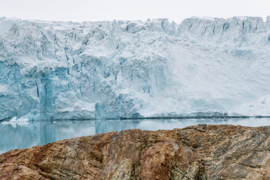
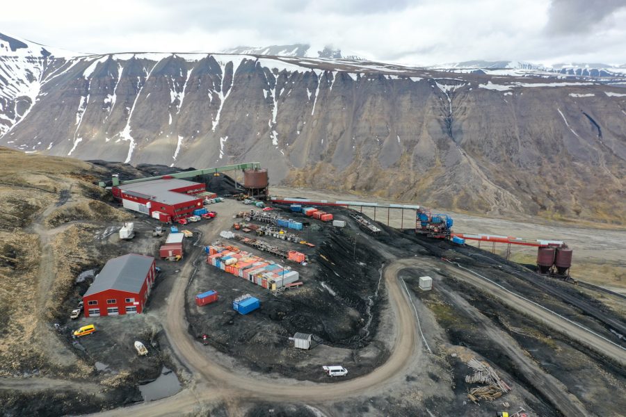
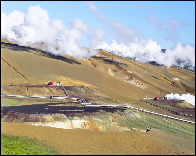
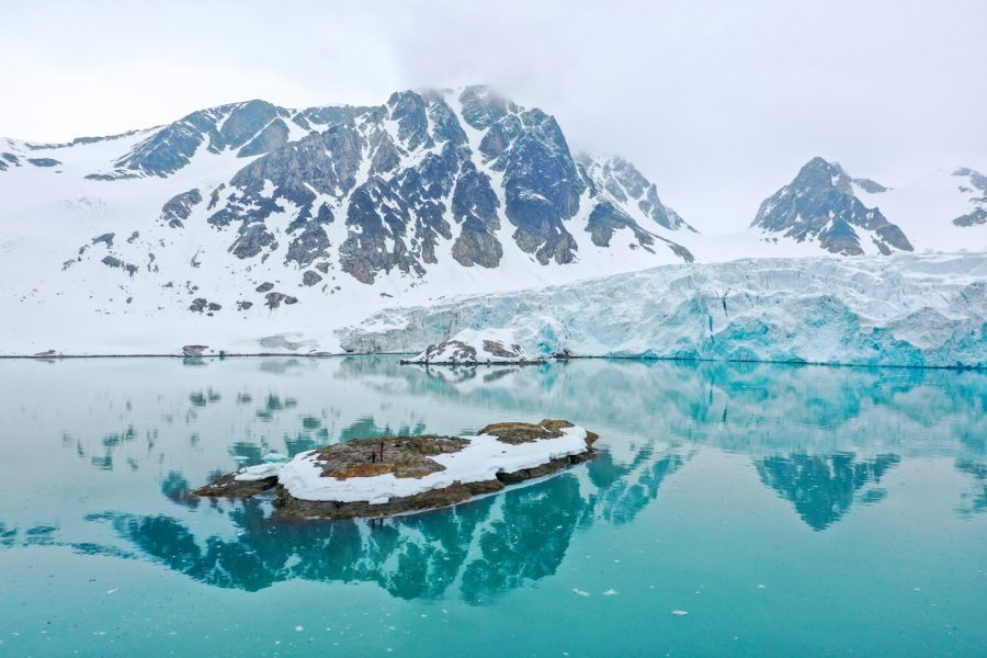
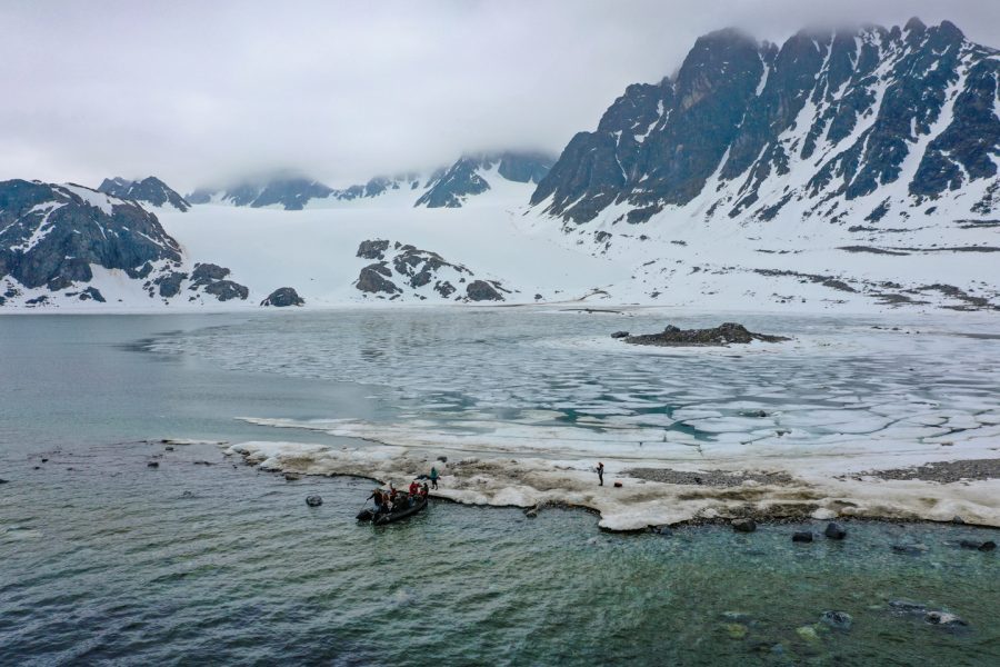
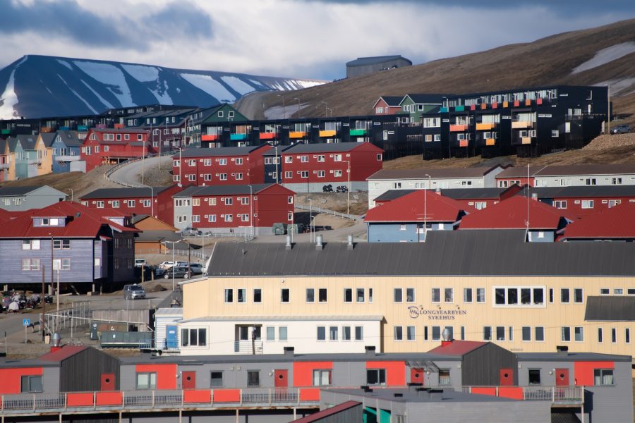
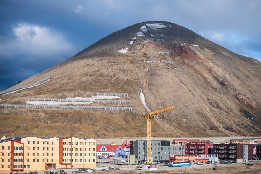
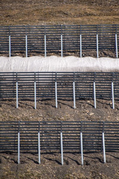
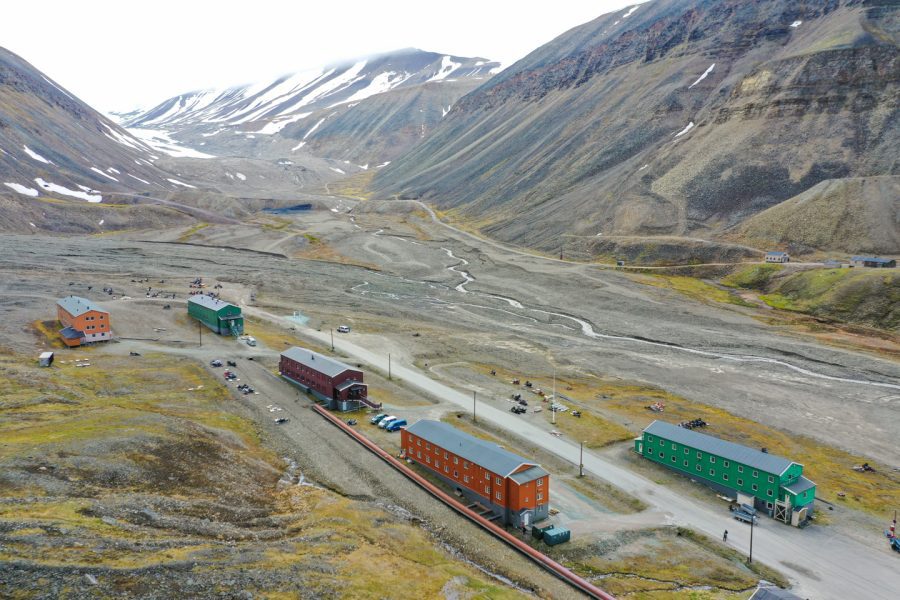
The Arctic is at a critical turning point. For most of human history, the forbidding region has been inaccessible to all but a few small groups of indigenous subsistence communities and elite European explorers. The twentieth century brought new exploration and increased industrial activity to these remote northern areas, but the cold winters and ice-packed oceans have proved to be formidable barriers to mass industrial expansion …until now.

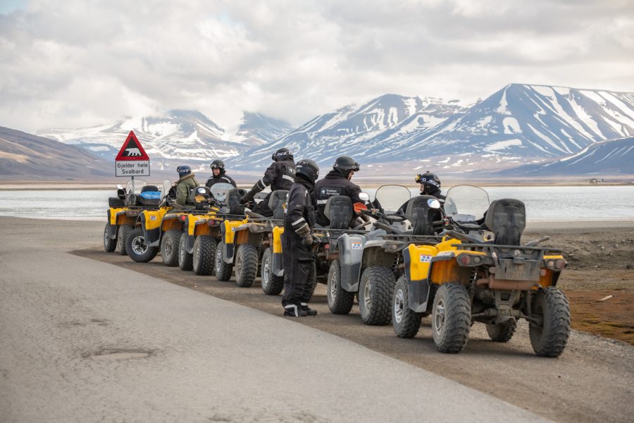
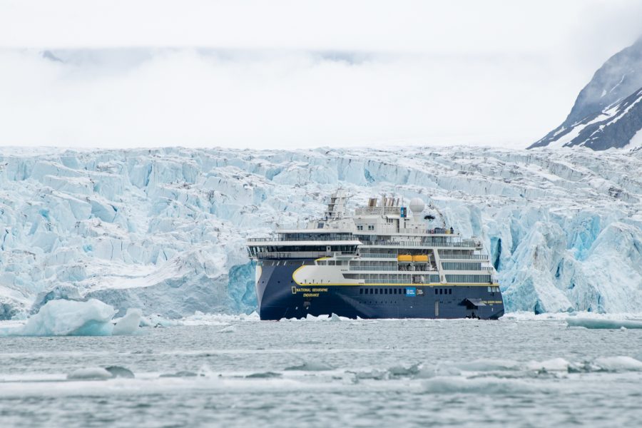
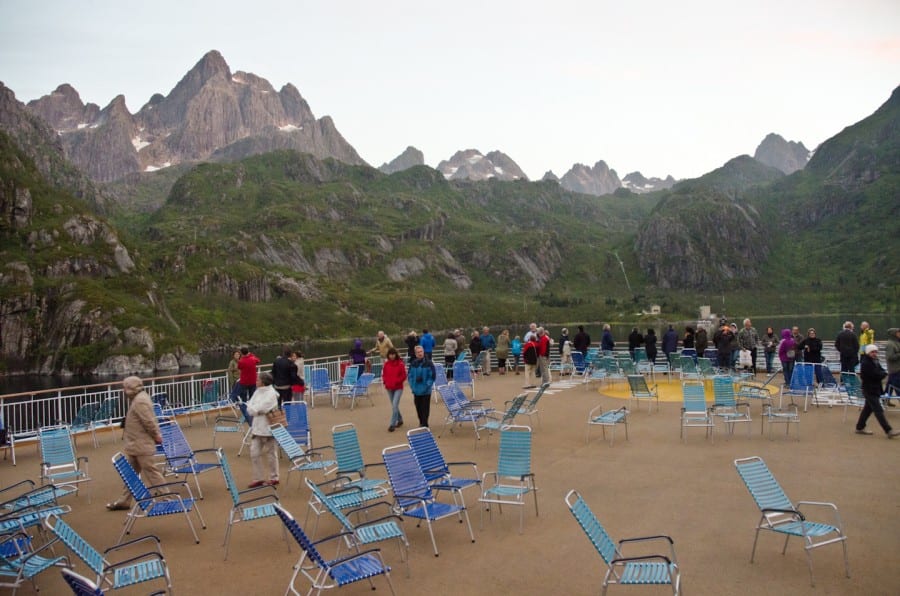
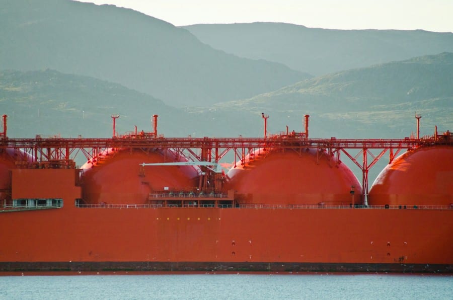
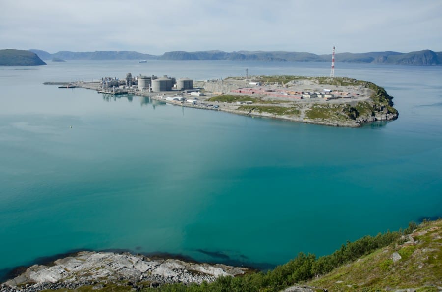
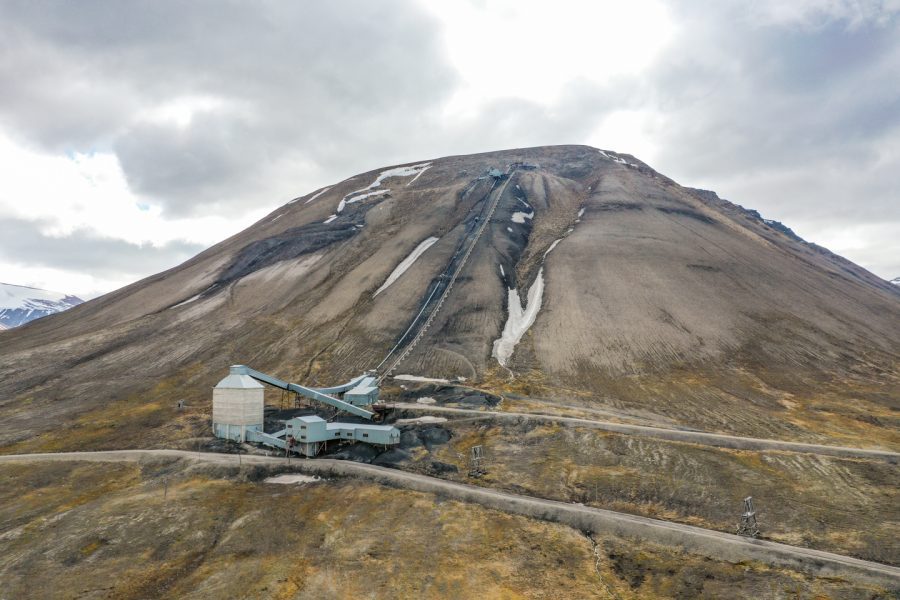
Global climate change has recently resulted in the warmest years on record, while increasing worldwide energy consumption has led to more aggressive searches for fossil fuels and other mineral resources. As the planet warms, and the sea ice melts at a record pace, stakeholders in energy, extraction, shipping, fishing, development, and tourism are taking full advantage of the region’s suddenly increasing accessibility. Some small towns are poised to become major hubs for transportation and extractive industry, while long fabled sea routes, including the Northwest Passage, are about to become viable for commercial shipping and tourism. Meanwhile many coastal communities are rapidly preparing to move inland before their hometowns are inundated by rising tides.

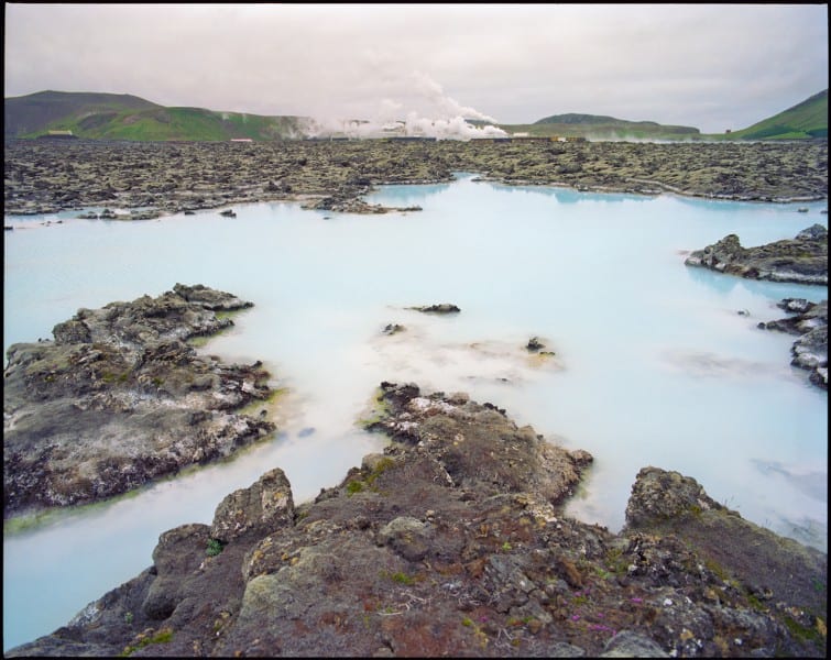
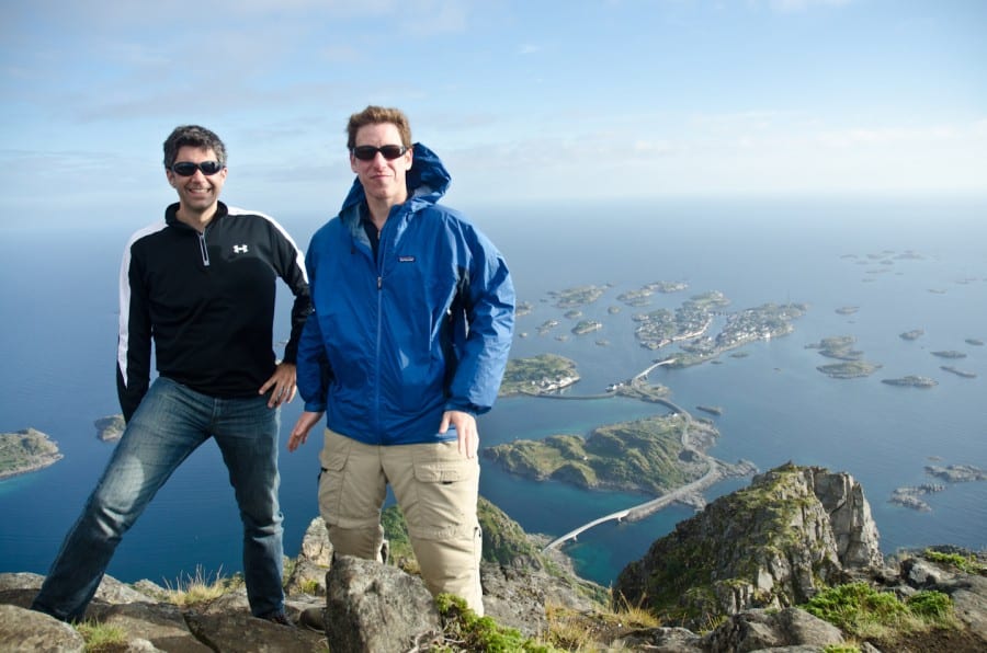
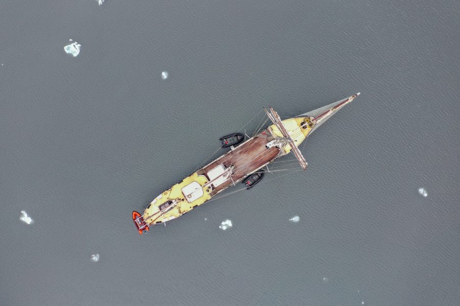
My goal, over many years, is to document in photographs the colonization of a new space, and to record the dramatic changes certain to occur in the remote areas of northern Alaska, Canada, Norway, Svalbard, Greenland, and Russia.

↑ back to top