Alexander Heilner

  • Projects
    • Draining the Colorado
    • The New Arctic
    • Last Cold Days
    • Imperial Water
    • Welcome Home
    • Synthetic Truth
    • E-470: Eastern Frontier
    • Development By Design
    • Biosphere 2
    • Extraction / Abstraction
    • Interweaving
    • Land Marks
    • Encyclopedia of NYC
    • Microbes
    • Leaving New York
    • Johns Hopkins Hospital
    • The Great Baltimore Fire
    • Landscapes by Night
    • Raleigh 2000
    • 47 (forty-seven) FRAMES
  • Information
    • News
    • Biography
    • Purchase
    • Links

Imperial Water

  • Project Statement »
The Imperial Dam
The Imperial Dam is the juncture at which nearly all of the remaining water from the Colorado River is diverted to Southern California for agricultural use. The Imperial Valley receives 20 percent of the total annual flow from the Colorado River Watershed.
The All American Canal (right), just south of its diversion from the Colorado River (left)
Just after passing through the Imperial Dam, the vast majority of the Colorado River's flow is now diverted westward via the All American Canal. The trickle that remains flows a few miles south, and over the Mexican border where it too is diverted for agriculture.
The All American Canal and Interstate 8
The All American Canal carries 20 percent of the Colorado River's annual flow into the Sonoran Desert of Southern California, where it is used to irrigate the agricultural industries of the Imperial Valley. A significant amount of water is lost through evaporation along the 82-mile journey.
The Coachella Canal diverting water from the All American Canal
The Coachella Canal diverts water from the All American Canal, and carries it northward to the Coachella Valley
The Coachella Canal
The Coachella Canal is a 122-mile aqueduct that conveys Colorado River water for irrigation northwest from the All-American Canal to the Coachella Valley north of the Salton Sea in Riverside County, California.
The All American Canal Arriving in the Imperial Valley, east of Calexico, California
After arriving at the Imperial Valley, the All American Canal flows just feet from the US border with Mexico, which is about 200 feet above sea level. Eventually the water is released to flow northward, and very gently downhill, across 2000 square kilometers of farmland, situated in one of the driest places in North America.
US Border Patrol at the All American Canal
Mexicali and The All American Canal
The US border with Mexico is clearly delineated. Mexicali, a city of 700,000 people sits on the south side, while California's Imperial Valley agricultural region lies to the north of the fence.
Irrigation Canal, Imperial Valley
Water use across the Western United States is facing increasingly high demand, due to growing populations, higher standards of living, and the effects of climate change. Agricultural Irrigation of the Imperial Valley is the single biggest use of the Colorado River, and thus an epicenter for questions about how to preserve and manage fresh water in the coming years.
Irrigation Canal near Bonds Corner, California
The Imperial Valley Irrigation District manages water rights and infrastructure that distributes water across more than 400,000 acres, thus turning a broad swath of the Sonoran Desert into one of the US' most productive agricultural regions.
Irrigation Canal near Bonds Corner, California
Lettuce Fields, Imperial Valley
One of the most productive agricultural regions in America, the Imperial Valley receives all of its water from the Colorado River, over 80 miles away.
Lettuce Fields, Imperial Valley
One of the most productive agricultural regions in America, the Imperial Valley receives all of its water from the Colorado River, over 80 miles away.
Lettuce Fields, Imperial Valley
One of the most productive agricultural regions in America, the Imperial Valley receives all of its water from the Colorado River, over 80 miles away.
Irrigation Canal near Bonds Corner, California
The Imperial Valley Irrigation District manages water rights and infrastructure that distributes water across more than 400,000 acres, thus turning a broad swath of the Sonoran Desert into one of the US' most productive agricultural regions.
Red Lettuce, Imperial Valley
One of the most productive agricultural regions in America, the Imperial Valley receives all of its water from the Colorado River, over 80 miles away.
Westmorland, California
Geothermal Energy, Imperial Valley
Mouth of the New River, Salton Sea
Agricultural waste fills the New River, which empties into the Salton Sea.
Southeast Shore, Salton Sea
As agricultural water use becomes more efficient, the runoff into the Salton Sea is being depleted, leaving a century of toxic materials to dry along its shores as it recedes.
Niland Boat Ramp, Salton Sea
As agricultural water use becomes more efficient, the runoff into the Salton Sea is being depleted, leaving a century of toxic materials to dry along its shores as it recedes.
The Salton Sea
As agricultural water use becomes more efficient, the runoff into the Salton Sea is being depleted, leaving a century of toxic materials to dry along its shores as it recedes.

Project Statement

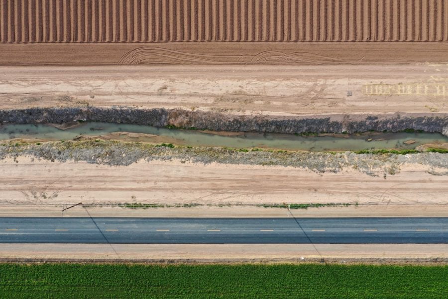
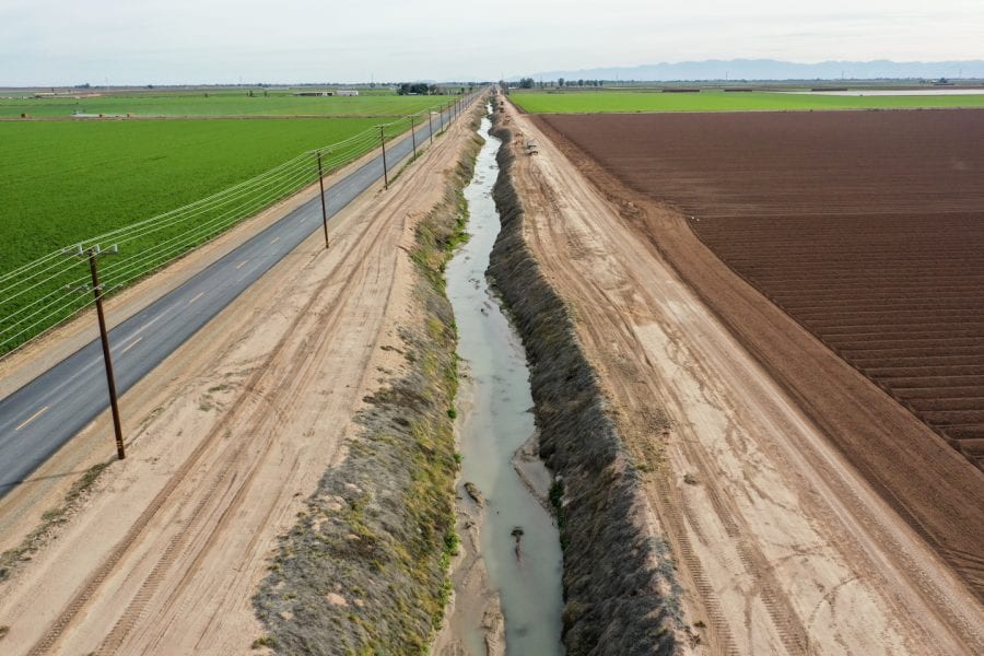
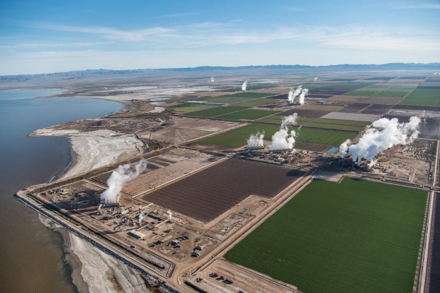
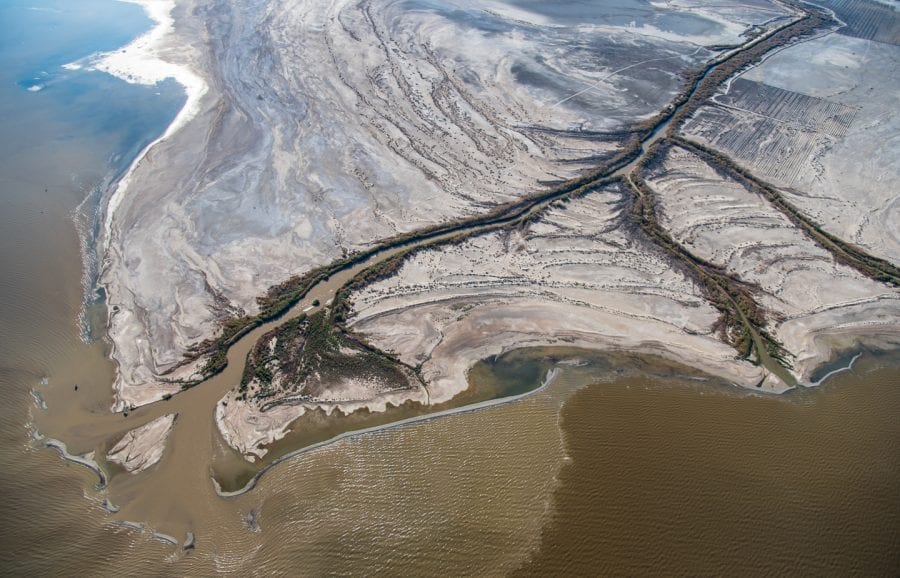
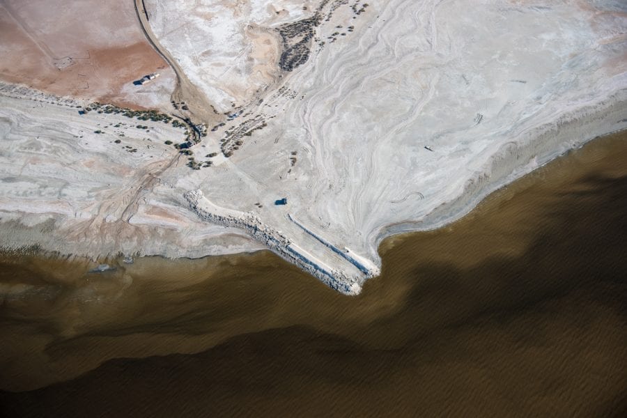
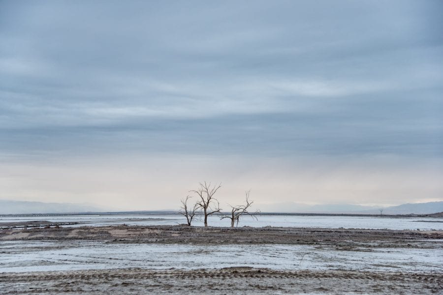
Water has always been one of the most compelling drivers of infrastructure in the American West. Natural sources of water have long been overburdened by the growing demands from consumer and agricultural development. Locals feel this pressure most acutely, but it affects the entire country through food and manufacturing that rely on western resources. Today, the Colorado River Basin and most of California’s watershed have been fully tapped, necessitating new ways to organize our lives – and our structures – around a finite supply of available water.

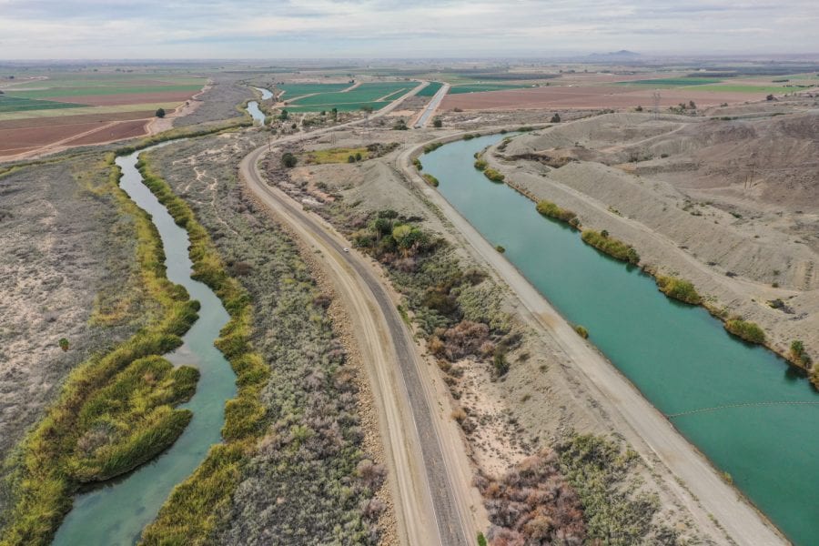
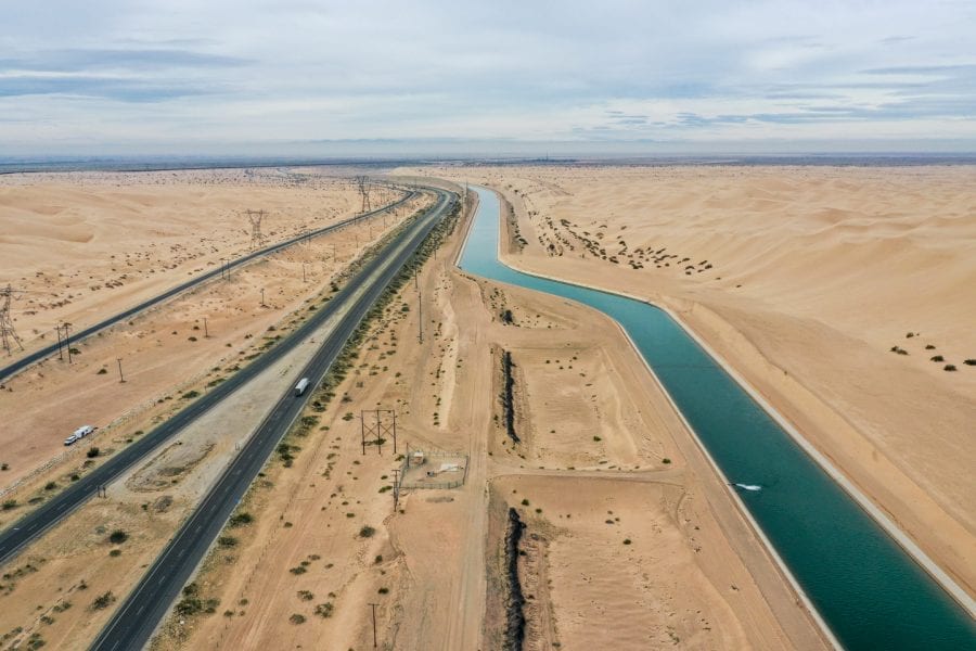
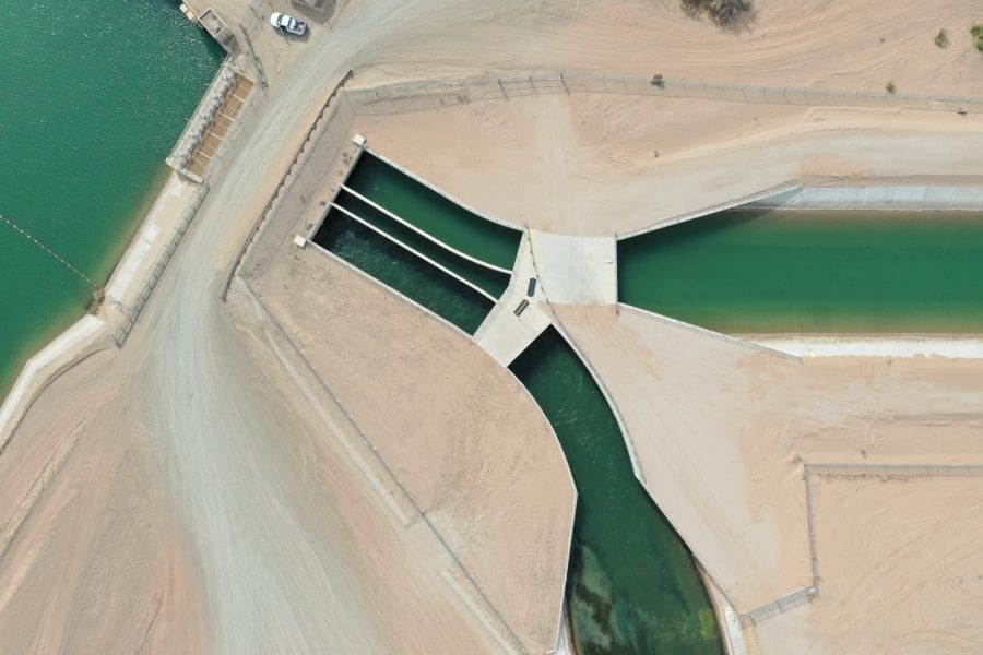
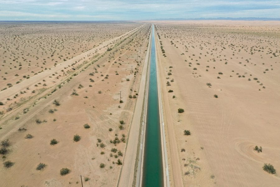
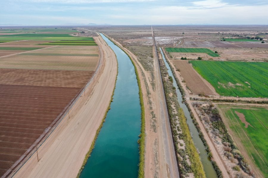
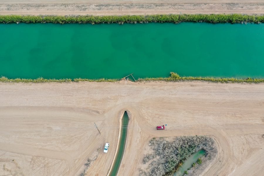
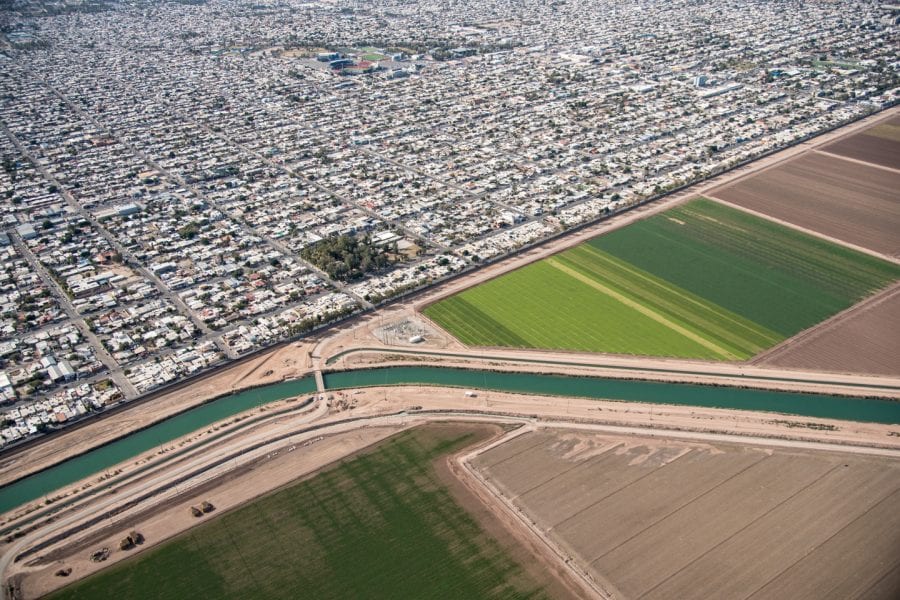
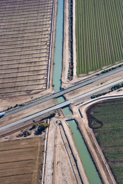
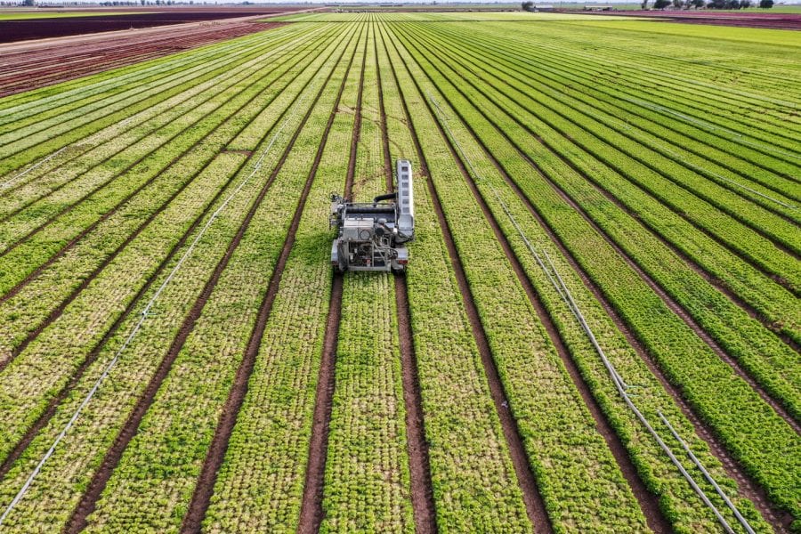
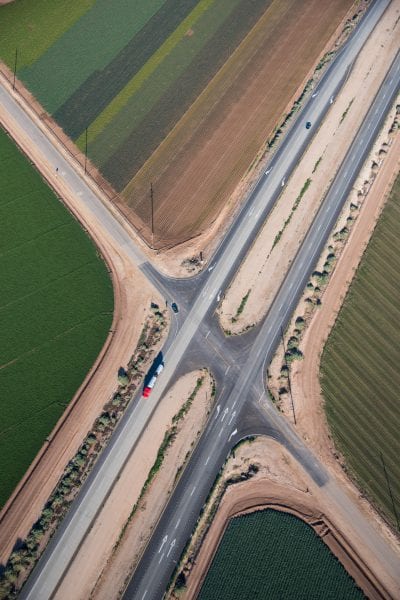
The Imperial Valley, the vast irrigated region of Southern California’s Sonoron desert, receives 20% of the annual flow of the Colorado River, thanks to water-rights laws enacted more than a century ago. After traveling through much of the American West, and nearly to the Mexican border, what remains of the Colorado is diverted at the Imperial Dam, and then transferred more than 80 miles westward, via the All American Canal, a feat of infrastructure engineering that is simple in its concept and yet profound in its consequences. The canal hugs the Mexican border until it releases its contents northward into hundreds of square miles of industrial farmland that sprouts copious green produce year-round, in one of the driest deserts on the North American continent.

↑ back to top