Alexander Heilner

  • Projects
    • Draining the Colorado
    • The New Arctic
    • Last Cold Days
    • Imperial Water
    • Welcome Home
    • Synthetic Truth
    • E-470: Eastern Frontier
    • Development By Design
    • Biosphere 2
    • Extraction / Abstraction
    • Interweaving
    • Land Marks
    • Encyclopedia of NYC
    • Microbes
    • Leaving New York
    • Johns Hopkins Hospital
    • The Great Baltimore Fire
    • Landscapes by Night
    • Raleigh 2000
    • 47 (forty-seven) FRAMES
  • Information
    • News
    • Biography
    • Purchase
    • Links

Draining the Colorado

  • Project Description »
Receding Waters, Lake Mead, Arizona
Receding Waters at Lone Rock, Lake Powell, Utah, May 2021
Receding Waters, Lake Powell, Utah
Sun City Festival, Buckeye, Arizona
Las Vegas, Nevada
Hite Marina, Lake Powell
The water level at Lake Powell has been dropping for most of the past two decades. All but three of the major boat ramps around the enormous lake are well out of the water as of 2022. Hite North Marina was one of the first to become unusable many years ago. The lake has receded so far that Hite now faces a narrow strip of the Colorado River, rather than the reservoir which used to lap at its boat ramp.
Receding Waters, Lake Powell, Utah
Lake Powell, near Bullfrog, Utah
Receding Waters, Lake Mead, Arizona
Closed Launch Ramp, Bullfrog Marina
Lake Powell, Utah
Receding Water, Lake Powell, Utah
Smith Fork Canyon, Lake Powell
Ghost Trees, Lost Eden Canyon, Utah.
Lake Powell, October 2022
Glen Canyon Dam, Arizona
Antelope Point Marina, Lake Powell, Arizona
Receding Waters at Wahweap Marina, Lake Powell, Arizona
Antelope Point Boat Ramp, Lake Powell, Arizona
Halls Crossing, October, 2022
Bullfrog Marina, Lake Powell, October 2022
Closed Launch Ramp, Bullfrog Marina
Bullfrog Marina, Lake Powell
Everywhere you looked around the undulating shoreline of Bullfrog Marina in 2022, you could see reminders of how much higher the waterline had been just one year earlier. Detritus that used to be floating dropped in place so quickly that no one had the time or resources to consider what to do with it as the water receded.
Halls Crossing Marina, October 2022
Lake Mead, Arizona
Glen Canyon Dam, Arizona
Transmission Lines, Hoover Dam, Arizona
New Housing Development, Henderson, Nevada
Lake Las Vegas, Nevada
Las Vegas, Nevada
Las Vegas, Nevada
Paiute Golf Resort, Las Vegas, Nevada
Lake Havasu City, Arizona
Site Six Boat Launch, Lake Havasu City, Arizona
Central Arizona Project Intake, Lake Havasu, Arizona
The Central Arizona Project Canal
The Central Arizona Project Canal and Interstate 10
Central Arizona Project Canal, Phoenix.
Central Arizona Project Canal, Scottsdale.
Central Arizona Project Canal, Phoenix, Arizona
Lees Ferry, Arizona
Marble Canyon and Navajo Bridge, Arizona
Colorado River
Henderson, Nevada
The Parker Strip, California
Palo Verde Diversion Dam, Colorado River
Colorado River, south of Parker, Arizona
Colorado River Agriculture, Blythe, California
Irrigation Headgates, near Poston, Arizona
Irrigation Headgate, Near Poston, Arizona
Green River, Utah
Green River, Utah
Mouth of the Bill Williams River, Lake Havasu, Arizona
Lake Granby, Colorado
Confluence of the Blue River and Colorado River, near Kremling, Colorado
The Blue River is the first major tributary encountered by the Colorado River as it makes its way south and west from its source. Prior to their meeting here, outside Kremmling, the two rivers have followed very similar paths. Each has flowed about 45 miles from the edge of the continental divide; through steep, rugged valleys, open parkland, residential towns, and tourist resorts; through a major reservoir and several smaller ones. The idea that one subsumes the other is really a fairly arbitrary distinction at this juncture.
The Confluence of the Verde River and the Salt River, near Phoenix.
Intrepid Potash Mine, near Moab, Utah
The Intrepid Potash Mine lies 10 miles south of Moab, Utah, and just uphill from the Colorado River. The mine pumps river water into underground deposits of potash (potassium chloride), and flushes the minerals out into massive evaporation ponds, where they settle for nearly a year before being collected.
Intrepid Potash Mine and the Colorado River
The Intrepid Potash Mine lies 10 miles south of Moab, Utah, and just uphill from the Colorado River. The mine pumps river water into underground deposits of potash (potassium chloride), and flushes the minerals out into massive evaporation ponds, where they settle for nearly a year before being collected.
Intrepid Potash Mine, near Moab, Utah
The Intrepid Potash Mine lies 10 miles south of Moab, Utah, and just uphill from the Colorado River. The mine pumps river water into underground deposits of potash (potassium chloride), and flushes the minerals out into massive evaporation ponds, where they settle for nearly a year before being collected.
Potash Road, south of Moab, Utah
Wall Street, Moab, Utah
Bootlegger Canyon, near Moab, Utah
Uranium Mitigation Site, Moab, Utah
Uranium Disposal Cell, Thompson Springs, Utah
Radioactive waste disposal site, Crescent Junction, Utah.
Houseboat, Bullforg Marina
Houseboats, Ticaboo, Utah
North Boat Ramp, Bullfrog Marina
The Colorado RIver flowing into Lake Powell at "The Horn"; Glen Canyon, Utah
"Dominy" Silt Deposits, near Hite Utah.
Colorado River, south of Hite, Utah
Hite Overlook, Utah
Hite Marina, Lake Powell
Riparian plain, south of Hite, Utah
North Wash, Hite, Utah
The water level at Lake Powell has been dropping for most of the past two decades. All but three of the major boat ramps around the enormous lake are well out of the water as of 2022. Hite North Marina was one of the first to become unusable many years ago. The lake has receded so far that Hite now faces a narrow strip of the Colorado River, rather than the reservoir which used to lap at its boat ramp.
Hite Crossing Bridge, Utah
Confluence of the Green and Colorado Rivers
Green River, Canyonlands National Park

Project Description

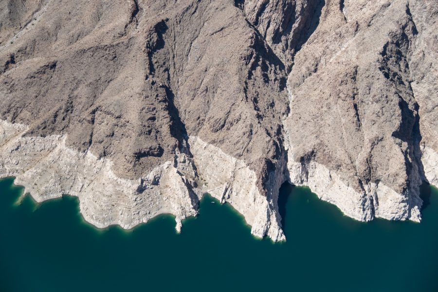
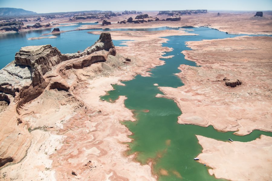
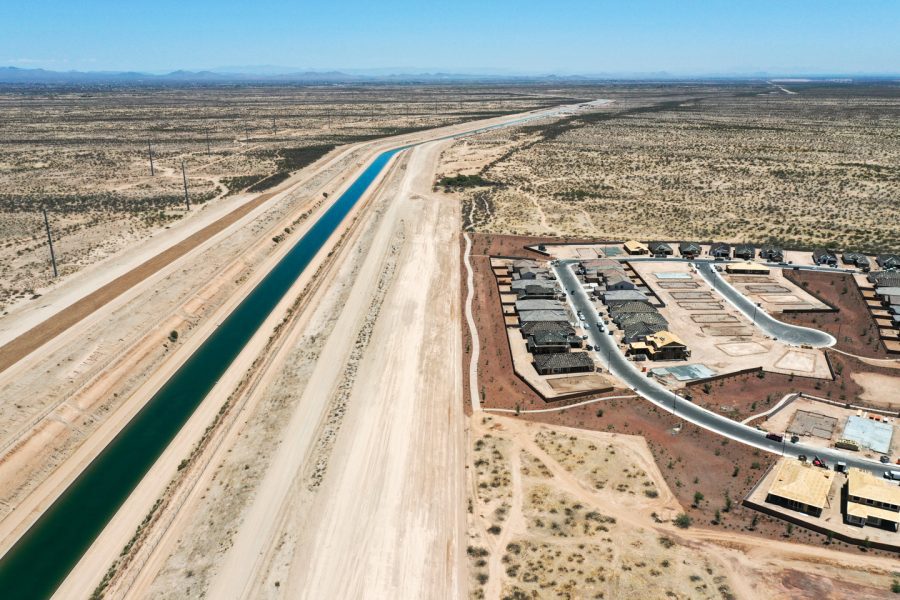
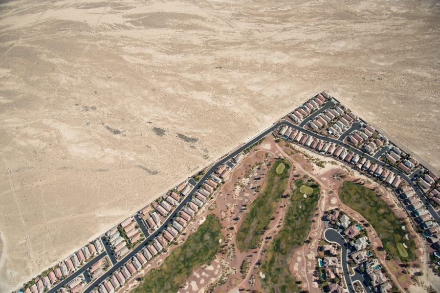
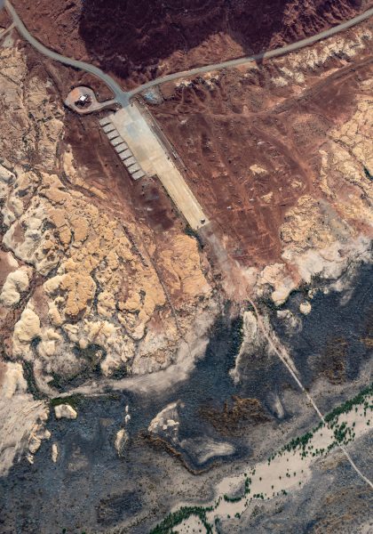
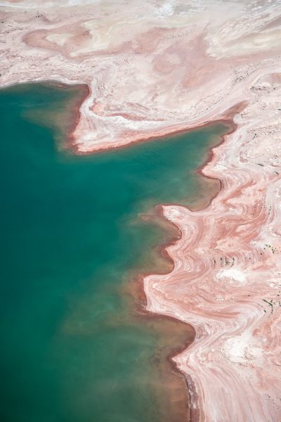
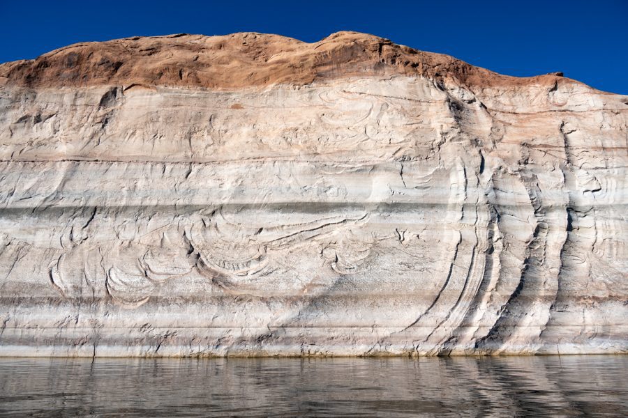
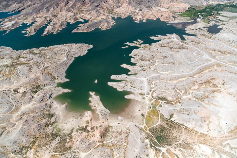
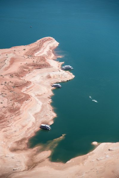
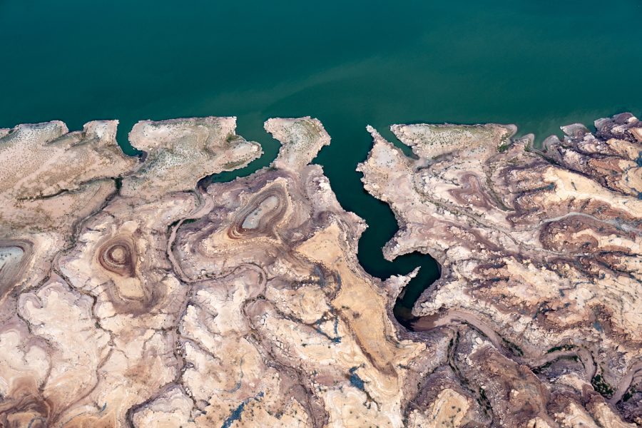
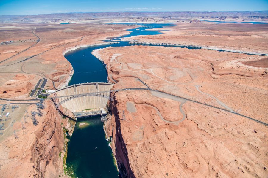
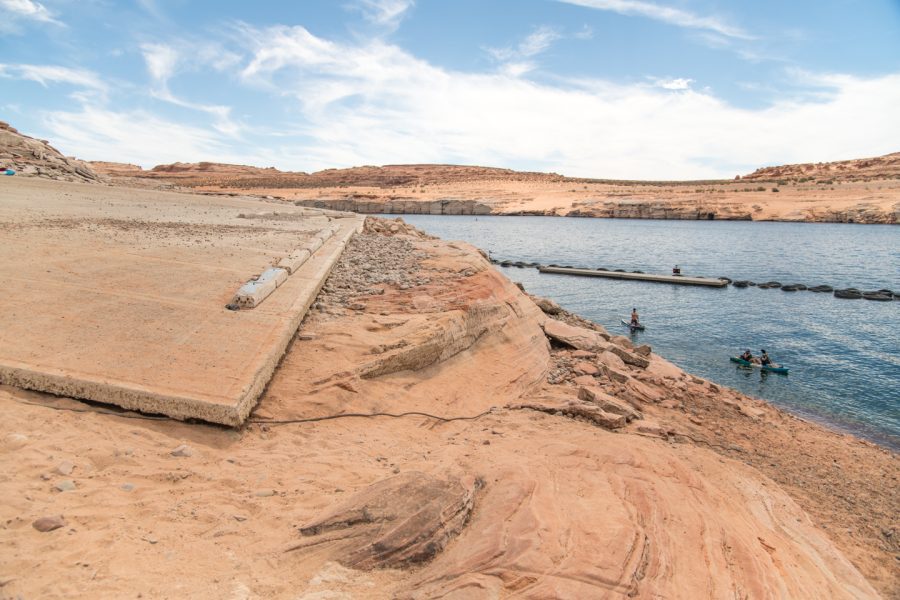
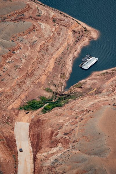
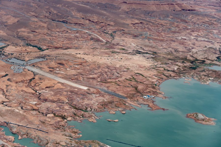
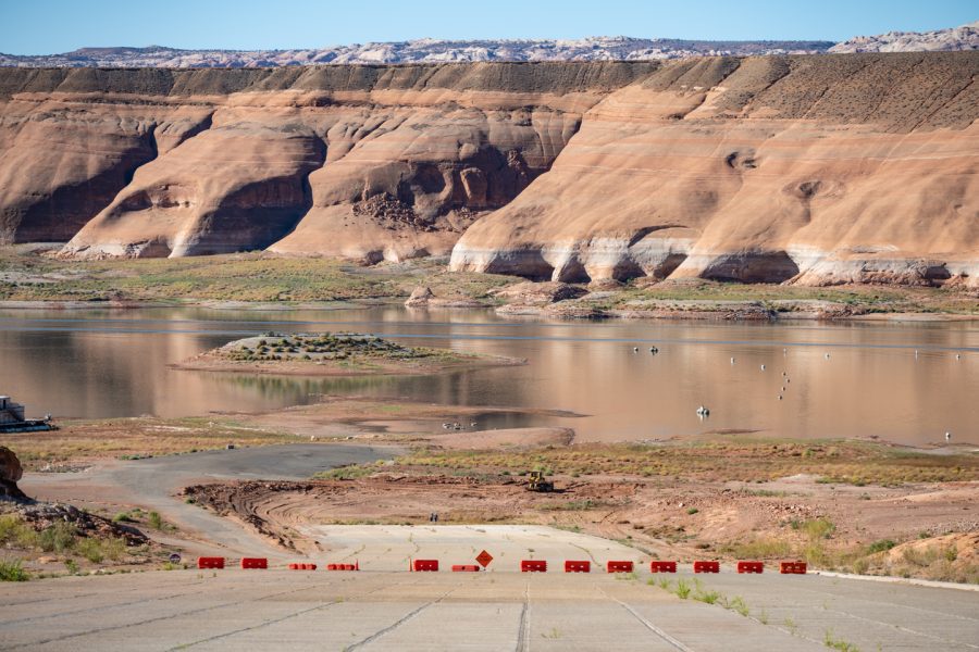
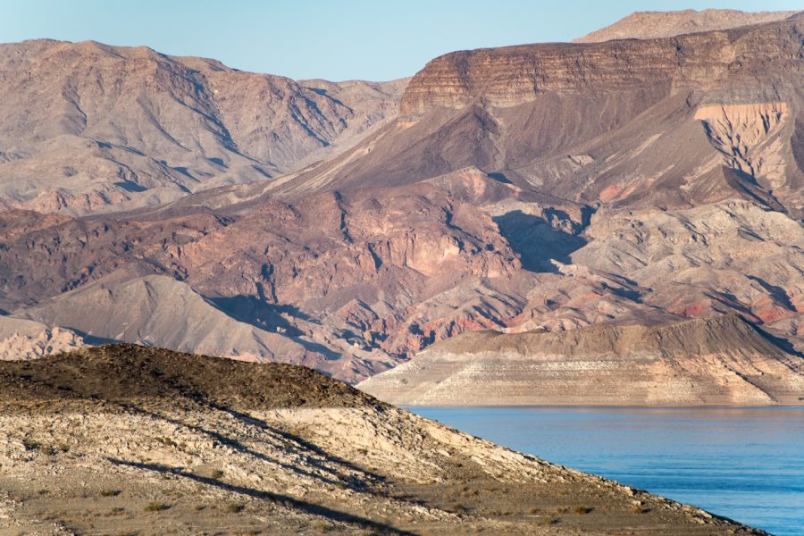
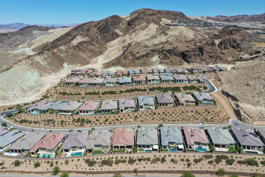
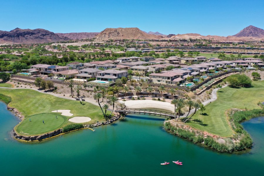
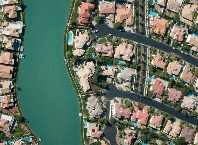
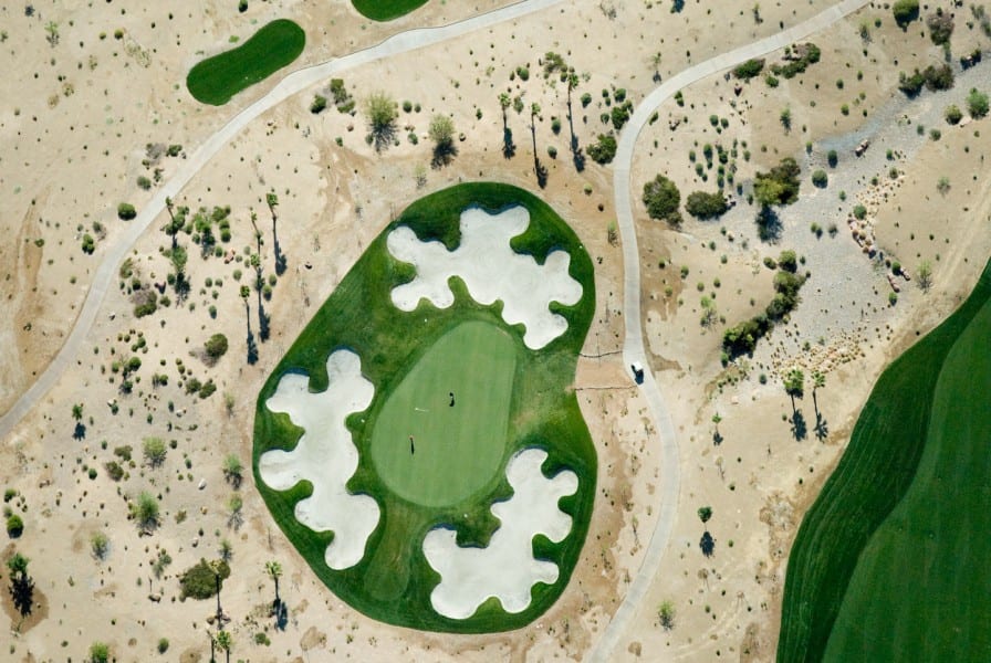
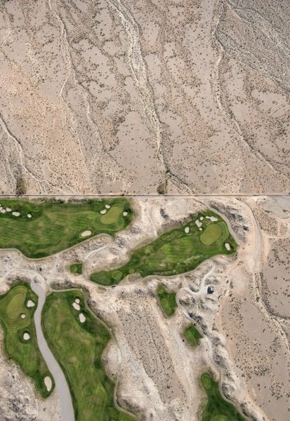
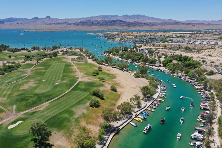
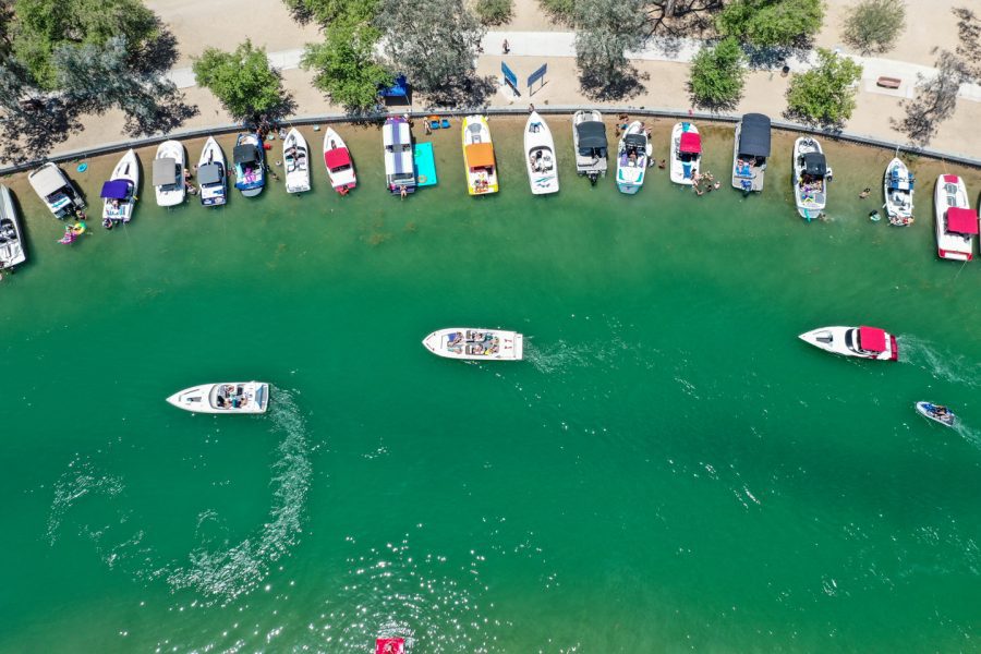
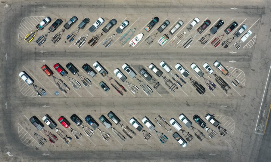
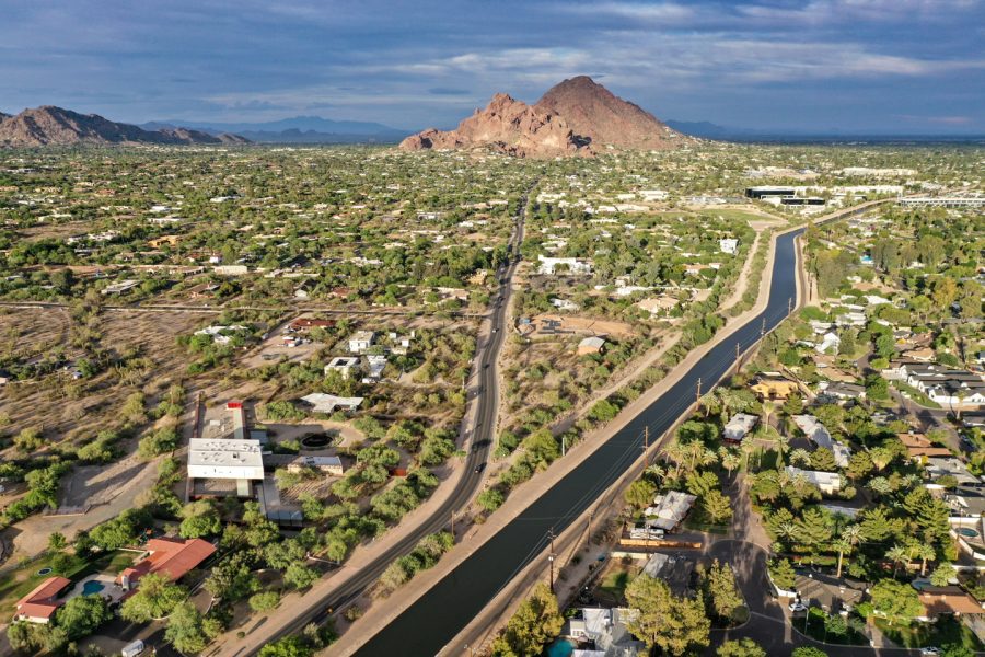
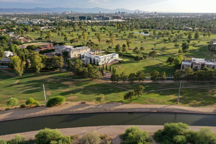
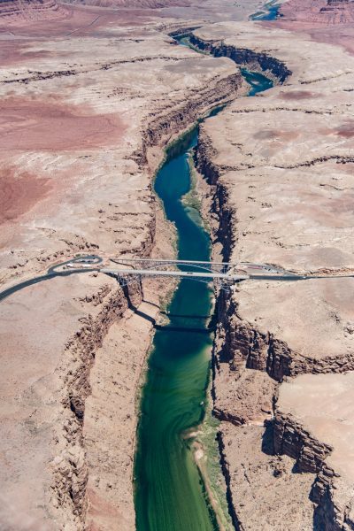
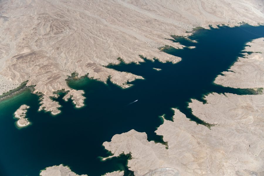
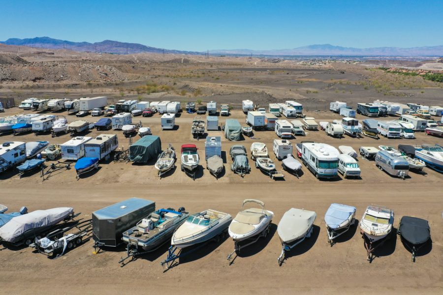
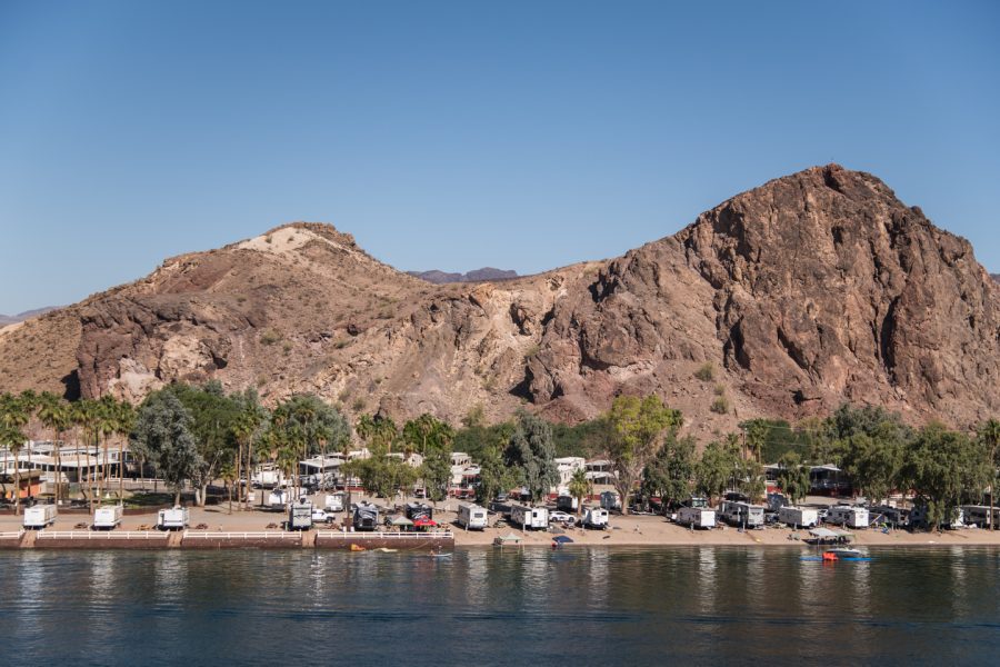
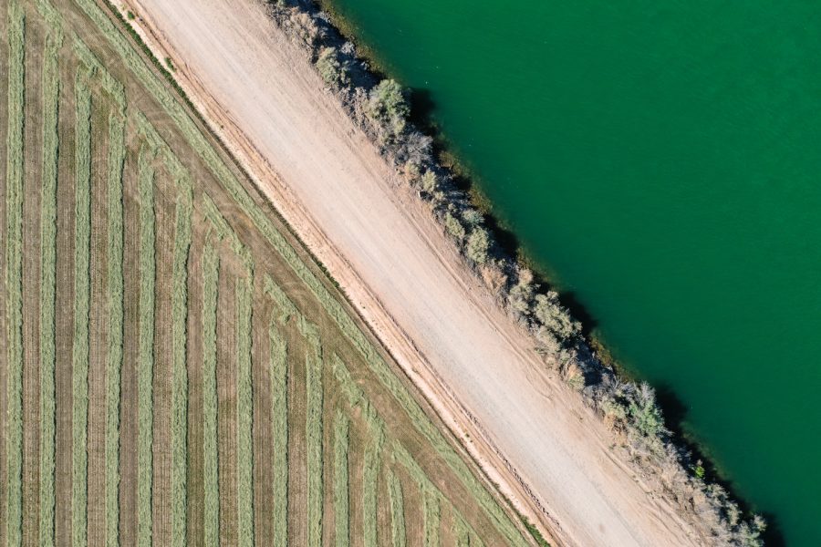
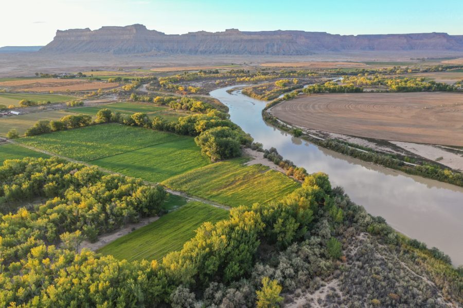
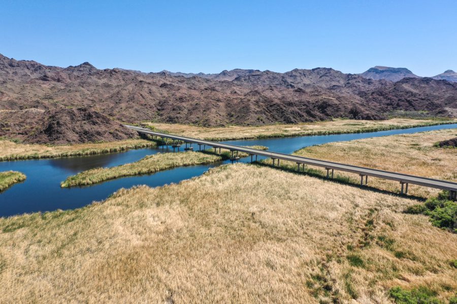
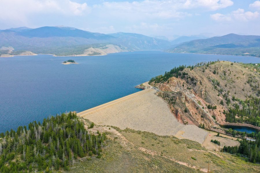
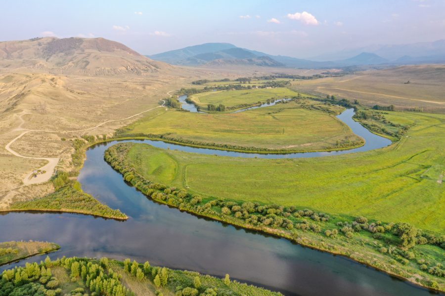
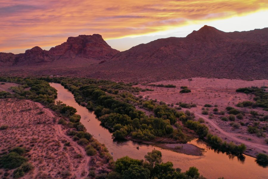
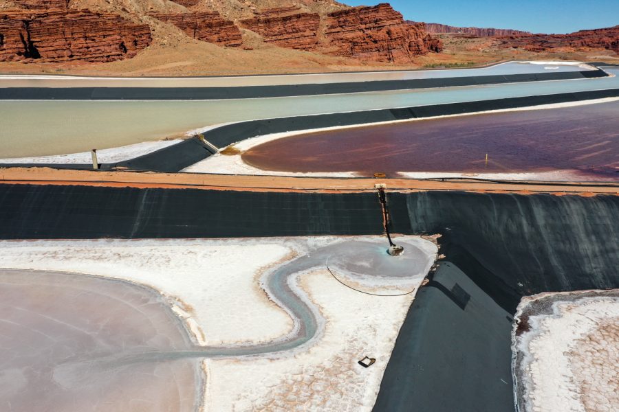
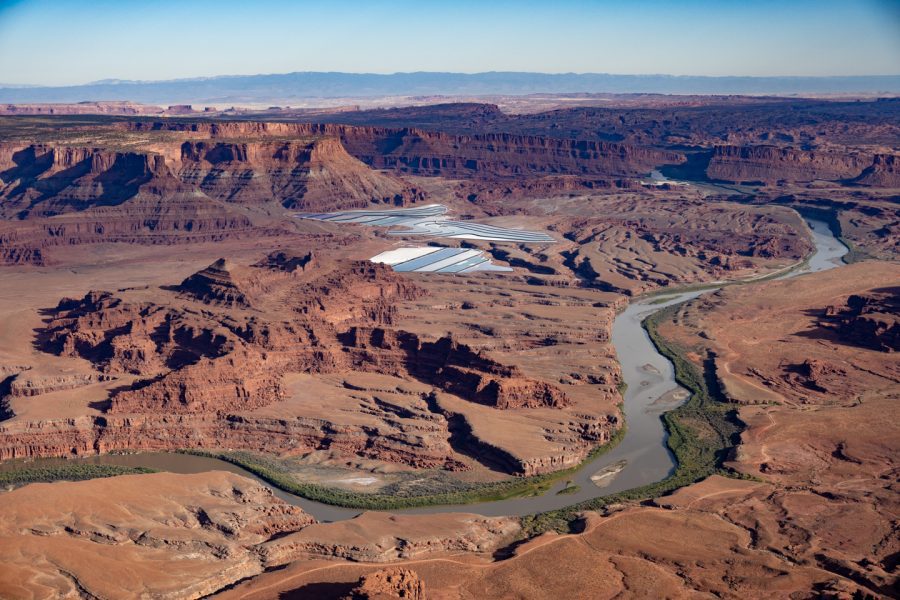
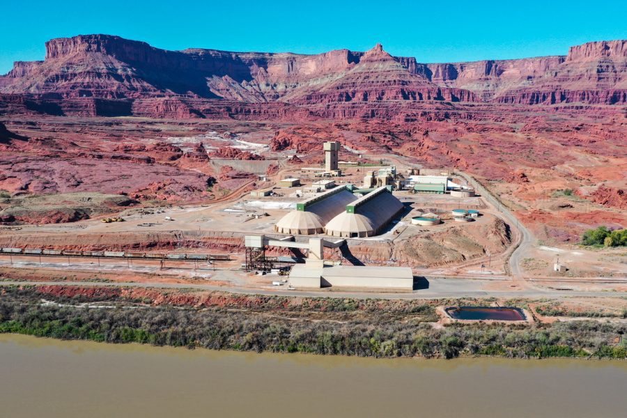
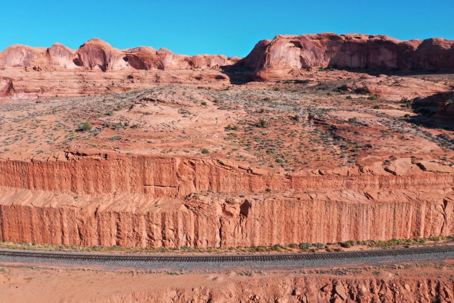
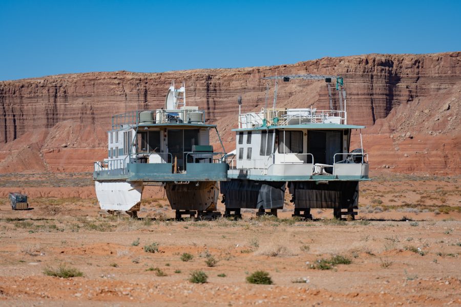
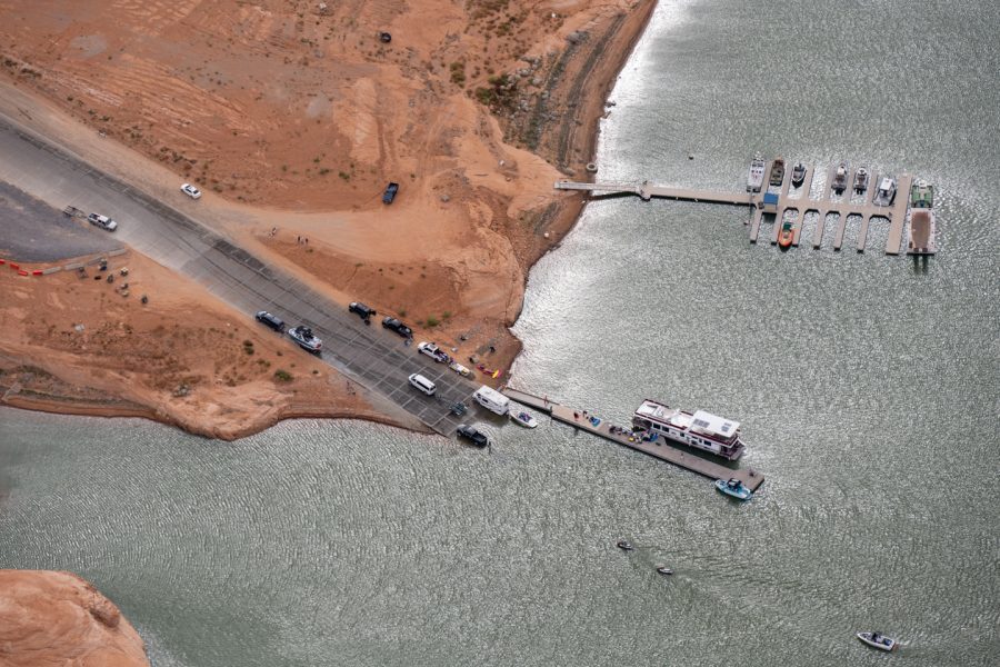
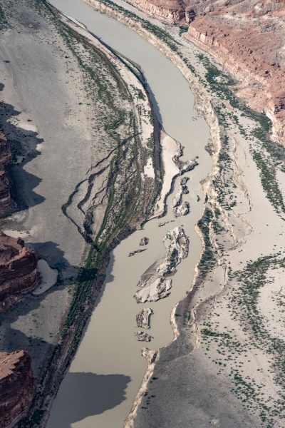
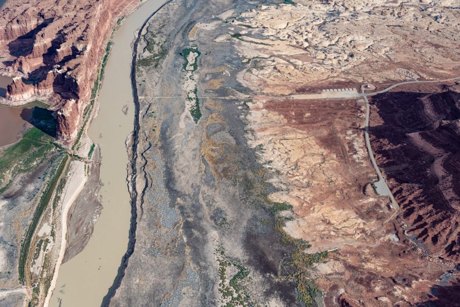
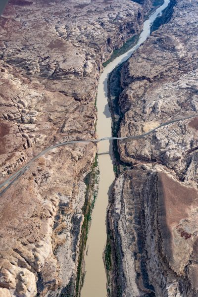
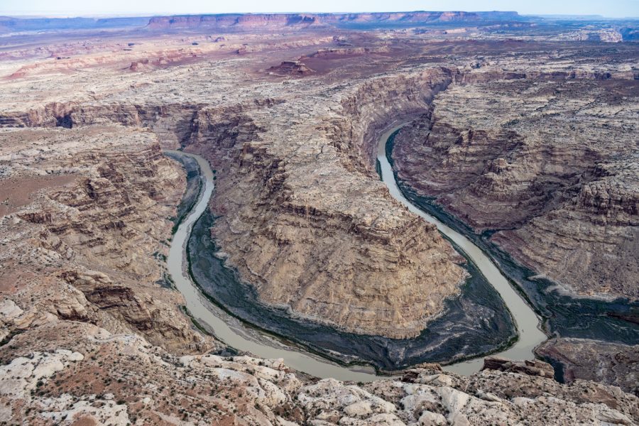
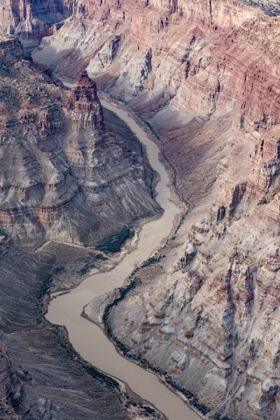
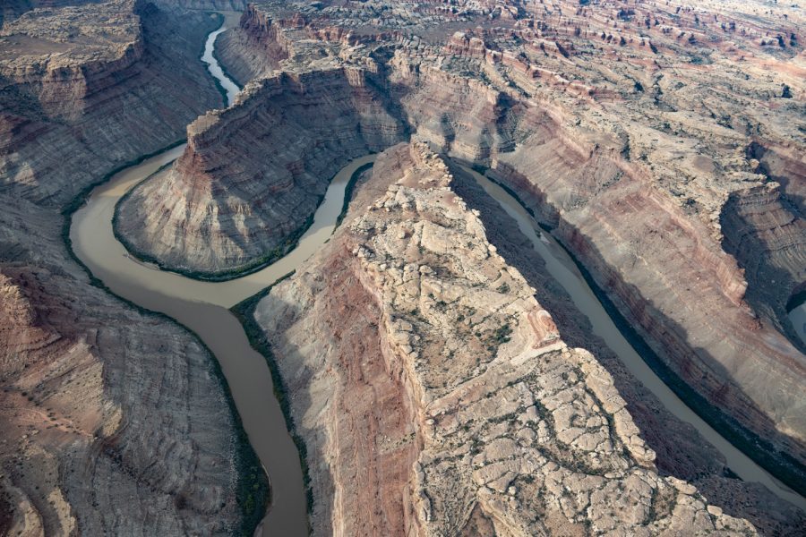
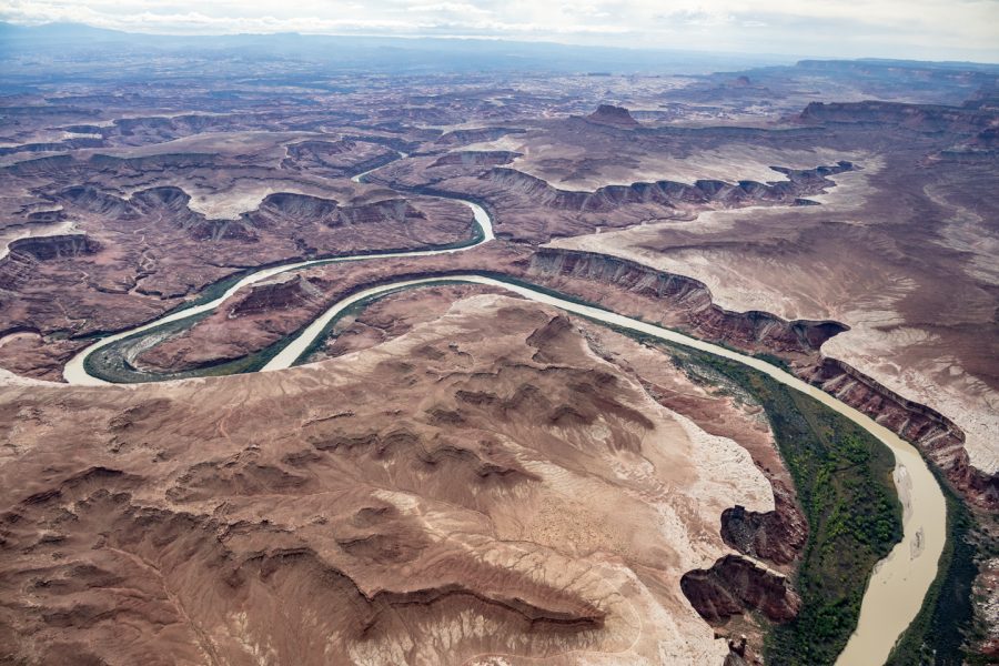
The Colorado River is in trouble. For hundreds of years, the river has been the lifeblood of the American Southwest, a region that is largely open desert, as well as dry plains, and mountainous forests. The river’s basin drains about 11% of the present-day United States, and at the same time delivers water to about 40 million people living (mostly) in the same area. But over the past century, and especially during the last two decades, rampant development of the Southwest and Rocky Mountains has dramatically increased demand for Colorado River water while a historic mega-drought, driven by global warming, has led to a looming environmental crisis. The entire annual flow of the Colorado River is over-allocated, and the river is literally running dry before it reaches the sea.

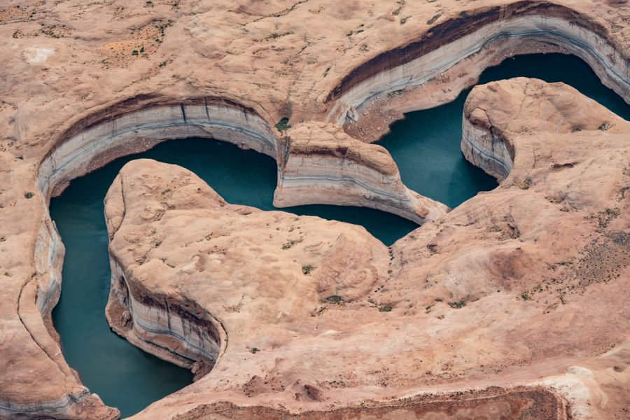
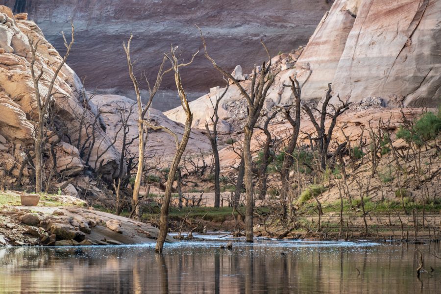
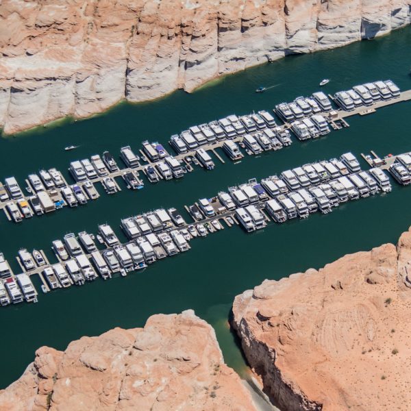
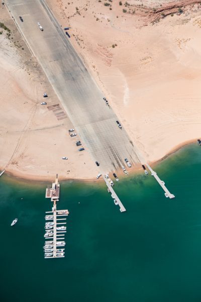
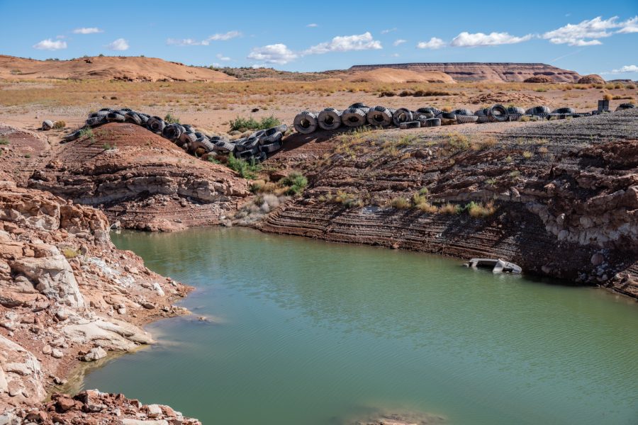
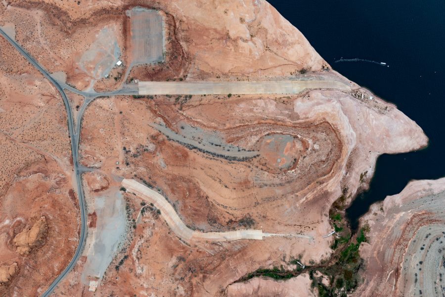
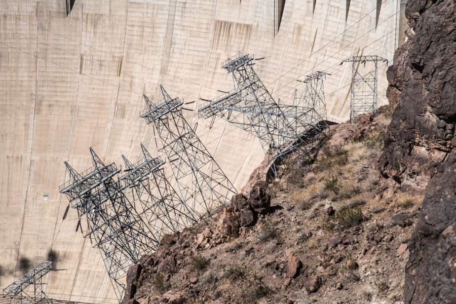
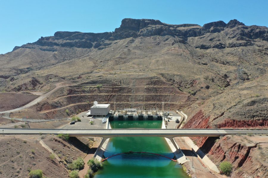
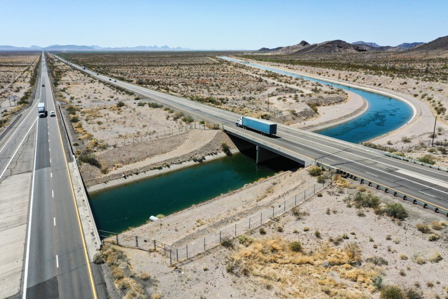
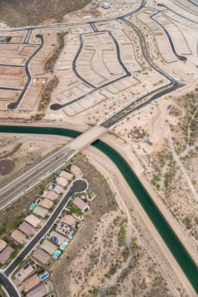
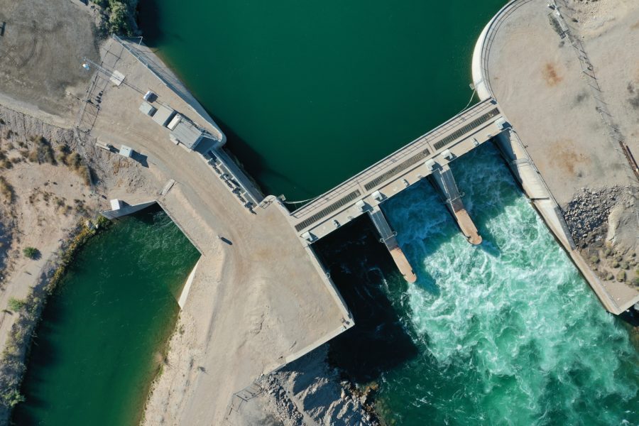
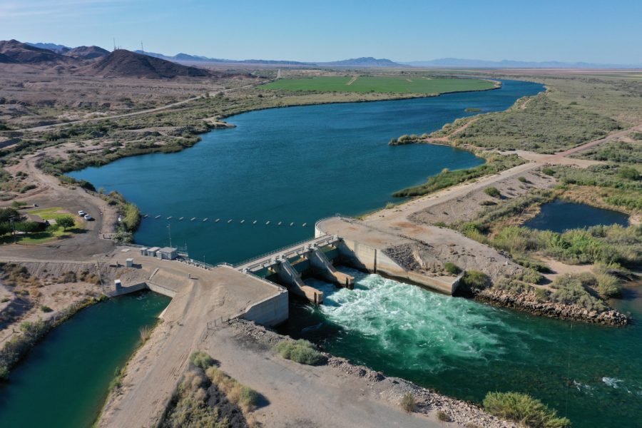
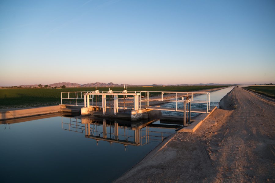
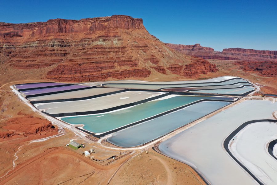
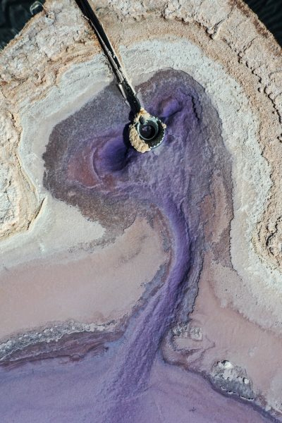
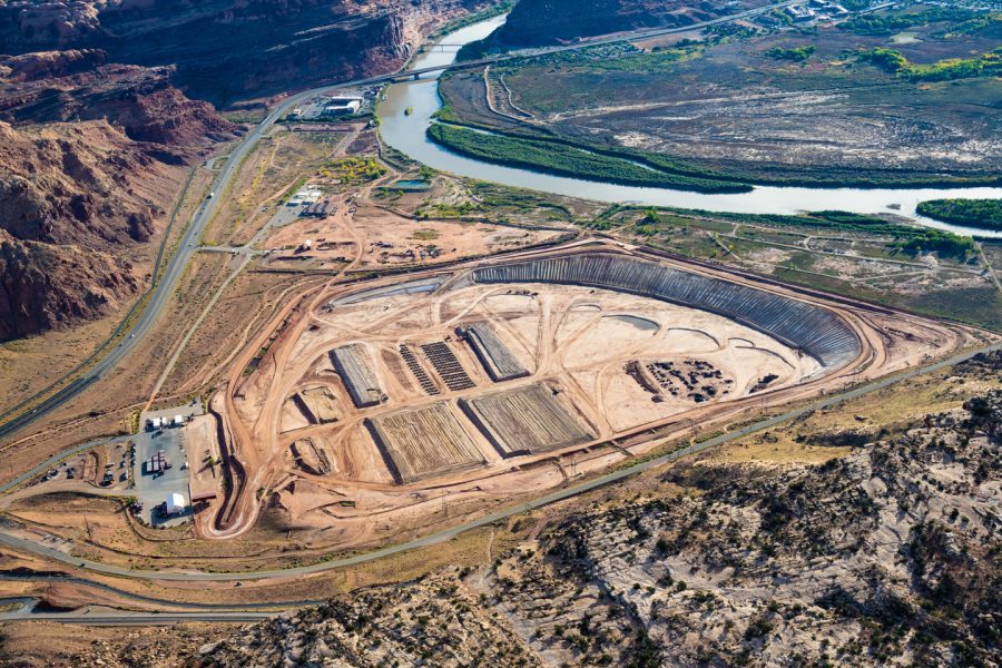
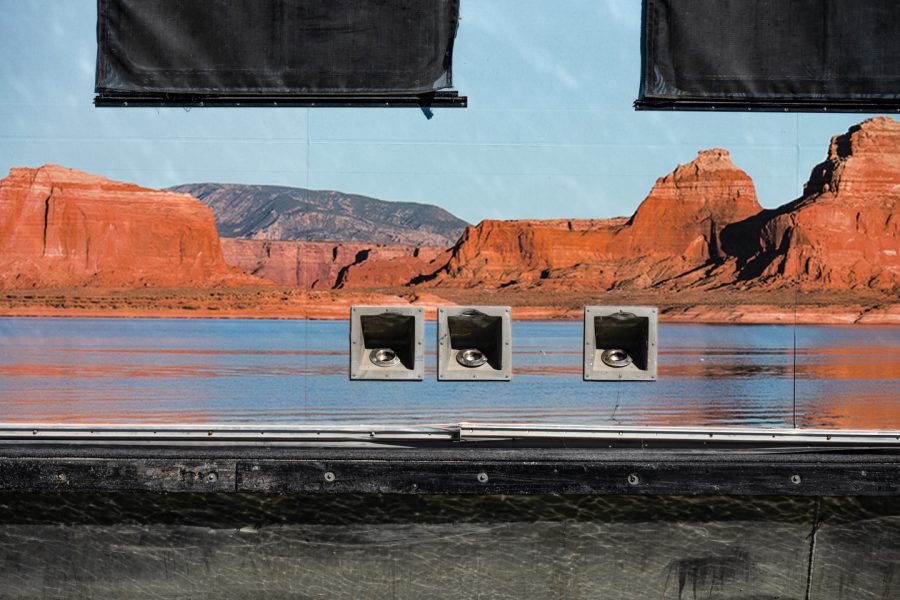
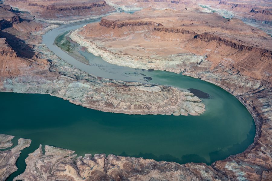
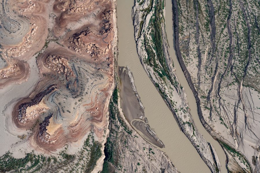
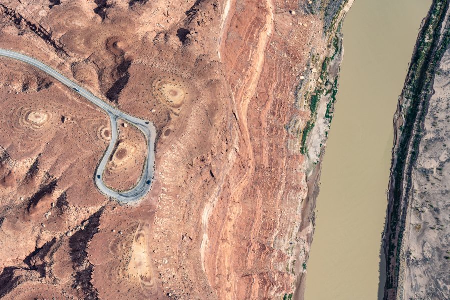
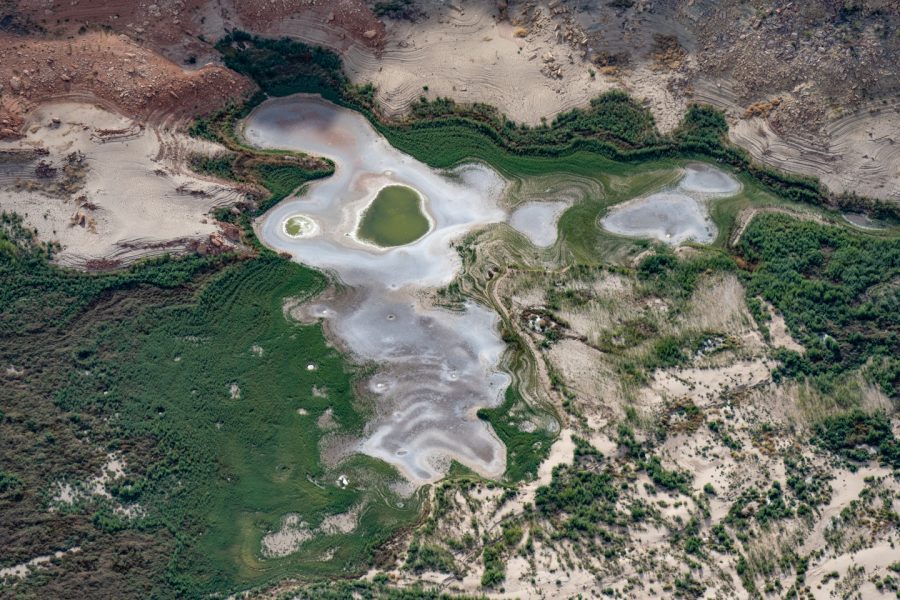
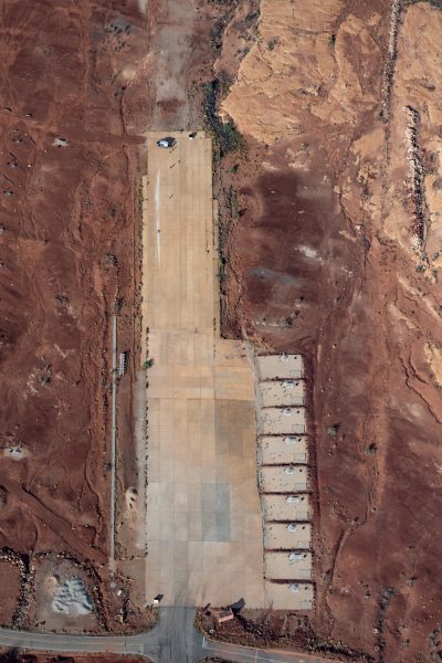
The contemporary Colorado River is actually not a single entity at all, but rather an infinitely complex system of tributaries, dammed reservoirs, infrastructural incursions, and siphons that disperse the water everywhere but its natural path. It is a climatic node, whose form depends upon snowfall in distant mountains, evaporation as it flows through the desert, and groundwater fluctuations in its surrounding terrain. The river is a social, economic, political, and spiritual totem for tens of millions of people who depend upon it, and its diminishment threatens to unravel their communities if it cannot be mitigated. Human variables affect every drop that flows – or doesn’t flow – through its channels, so millions of people will have to make difficult decisions very quickly in order to save the river as we know it.

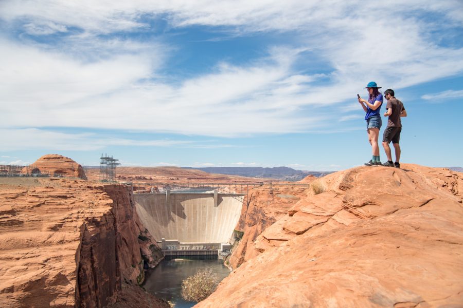
This project is an attempt to visually map these circumstances at this critical moment in time. I hope these photographs help to motivate smart decisions about water use in the near future. But I also see this project as a decidedly aesthetic record, for posterity, of how this natural resource was managed and mis-managed in my lifetime. Global warming is changing lands we take for granted right before our eyes, and the better we understand these shifts and our role in them, the better equipped we will be to reckon with them.

Aerial photography for this project has been generously supported by LightHawk.

↑ back to top